Sherman Township, Keweenaw County, Michigan
Sherman Township, Michigan | |
|---|---|
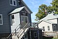
 Sherman Township Hall | |
 Location within Keweenaw County | |
 Sherman Township Location within the state of Michigan  Sherman Township Sherman Township (the United States) | |
| Coordinates: 47°14′24″N 88°13′58″W / 47.24000°N 88.23278°WCoordinates: 47°14′24″N 88°13′58″W / 47.24000°N 88.23278°W | |
| Country | United States |
| State | Michigan |
| County | Keweenaw |
| Government | |
| • Supervisor | Robin Middlemis Brown |
| • Clerk | JT Reno |
| Area | |
| • Total | 69.24 sq mi (179.3 km2) |
| • Land | 65.16 sq mi (168.8 km2) |
| • Water | 4.08 sq mi (10.6 km2) |
| Elevation | 778 ft (237 m) |
| Population (2010) | |
| • Total | 67 |
| • Density | 1.02/sq mi (0.39/km2) |
| Time zone | UTC-5 (Eastern (EST)) |
| • Summer (DST) | UTC-4 (EDT) |
| ZIP code(s) | |
| Area code(s) | 906 |
| FIPS code | 26-73220[1] |
| GNIS feature ID | 1627074[2] |
Sherman Township is a civil township of Keweenaw County in the U.S. state of Michigan. As of the 2010 census, the population was 67.
Sherman Township is the fourth-least populated municipality in the state of Michigan after Pointe Aux Barques Township, Grand Island Township, West Branch Township, and tied with Zilwaukee Township.
Communities[]
- Gay is an unincorporated community in the township, post office Lake Linden.
- Hebards or Hebard is an unincorporated community in the township at 47°17′06″N 88°17′50″W / 47.28500°N 88.29722°W.[3] It was a station on the and a post office opened on June 30, 1903. It was named for Charles and Edward Hebard, who operated sawmills on Keweenaw Bay.[4]
- Snowshoe is an unincorporated community in the township.
Geography[]
According to the United States Census Bureau, the township has a total area of 69.3 square miles (179.4 km2), of which 65.1 square miles (168.6 km2) is land and 4.2 square miles (10.8 km2) (6.03%) is water.
Demographics[]
As of the census[1] of 2000, there were 60 people, 34 households, and 14 families residing in the township. The population density was 0.9 per square mile (0.4/km2). There were 113 housing units at an average density of 1.7 per square mile (0.7/km2). The racial makeup of the township was 98.33% White, and 1.67% from two or more races. 46.2% were of Finnish, 11.5% Irish, 7.7% French, 5.8% Dutch, 5.8% German, 5.8% Polish, 5.8% Scandinavian, and 5.8% Slavic ancestry.
There were 34 households, out of which 11.8% had children under the age of 18 living with them, 32.4% were married couples living together, 8.8% had a female householder with no husband present, and 58.8% were non-families. 58.8% of all households were made up of individuals, and 29.4% had someone living alone who was 65 years of age or older. The average household size was 1.76 and the average family size was 2.79.
In the township the population was spread out, with 15.0% under the age of 18, 1.7% from 18 to 24, 20.0% from 25 to 44, 30.0% from 45 to 64, and 33.3% who were 65 years of age or older. The median age was 52 years. For every 100 females, there were 122.2 males. For every 100 females age 18 and over, there were 112.5 males.
The median income for a household in the township was $27,000, and the median income for a family was $45,833. Males had a median income of $26,250 versus $0 for females. The per capita income for the township was $17,989. There were no families and 12.7% of the population living below the poverty line, including no individuals under eighteen and 23.8% of those over 64.
Images[]

Fire Station
Community Center


References[]
- ^ a b "U.S. Census website". United States Census Bureau. Retrieved 2008-01-31.
- ^ U.S. Geological Survey Geographic Names Information System: Sherman Township, Keweenaw County, Michigan
- ^ U.S. Geological Survey Geographic Names Information System: Hebards, Michigan
- ^ Romig, Walter (1986) [1973]. Michigan Place Names. Detroit, Michigan: Wayne State University Press. ISBN 0-8143-1838-X.
Municipalities and communities of Keweenaw County, Michigan, United States | ||
|---|---|---|
| Village |  | |
| Civil townships | ||
| CDPs | ||
| Other communities |
| |
| Ghost towns | ||
| ||
- Townships in Michigan
- Townships in Keweenaw County, Michigan
- Houghton micropolitan area, Michigan
- Michigan populated places on Lake Superior