Shin-Yokohama Station
JH16  Shin-Yokohama Station 新横浜駅 | ||||||||||||||||||||||||||||||||||||||||||||
|---|---|---|---|---|---|---|---|---|---|---|---|---|---|---|---|---|---|---|---|---|---|---|---|---|---|---|---|---|---|---|---|---|---|---|---|---|---|---|---|---|---|---|---|---|
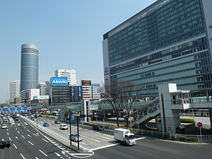 The main station building and forecourt in March 2012 | ||||||||||||||||||||||||||||||||||||||||||||
| Location | Shinohara-chō, Kōhoku-ku, Yokohama-shi, Kanagawa-ken Japan | |||||||||||||||||||||||||||||||||||||||||||
| Operated by |
| |||||||||||||||||||||||||||||||||||||||||||
| Line(s) |
| |||||||||||||||||||||||||||||||||||||||||||
| Connections | Bus terminal | |||||||||||||||||||||||||||||||||||||||||||
| History | ||||||||||||||||||||||||||||||||||||||||||||
| Opened | 1964 | |||||||||||||||||||||||||||||||||||||||||||
| Passengers | ||||||||||||||||||||||||||||||||||||||||||||
| JR East, FY2012 | 57,439 daily | |||||||||||||||||||||||||||||||||||||||||||
| Services | ||||||||||||||||||||||||||||||||||||||||||||
| ||||||||||||||||||||||||||||||||||||||||||||
| Location | ||||||||||||||||||||||||||||||||||||||||||||
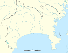 Shin-Yokohama Location within Kanagawa Prefecture | ||||||||||||||||||||||||||||||||||||||||||||

Shin-Yokohama Station (新横浜駅, Shin-yokohama-eki) is a railway station in Yokohama, Japan, jointly operated by Central Japan Railway Company (JR Central), East Japan Railway Company (JR East), and Yokohama City Transportation Bureau.
Lines[]
Shin-Yokohama Station is served by the Tōkaidō Shinkansen, Yokohama Line, and Yokohama Subway Blue Line.
Station layout[]
The station consists of an island platform at ground level serving the Yokohama Line, with two elevated island platforms for the shinkansen tracks overhead. The shinkansen platforms 2 and 3 have safety fences, as some trains passed non-stop through the station prior to 2008. The JR Central portion of the station includes a Midori no Madoguchi staffed ticket office. Also, The JR East portion of the station includes a Reserved Seat Ticket Vending Machines.
JR platforms[]
| 1,2 | ■ Tokaido Shinkansen | for Tokyo |
| 3,4 | ■ Tokaido Shinkansen | for Nagoya, Shin-Osaka, and Hakata |
| 5 | JH Yokohama Line | for Kikuna, Higashi-Kanagawa,Yokohama, and Ōfuna |
| 6 | JH Yokohama Line | for Machida and Hachiōji |

View of the shinkansen platforms from the eastern end of platform 3/4, February 2011

The Yokohama Line platforms, August 2008


Yokohama Municipal Subway platforms[]
| 1 | ■ Blue Line | for Yokohama,Kannai, Kami-Ōoka, Totsuka, and Shōnandai |
| 2 | ■ Blue Line | for Azamino |
History[]
Real estate agents purchased the private property in the area by telling residents and local government officials that the land was needed to build a Nissan/Ford motor vehicle factory which would provide increased employment. Actually, however, the agents were in league with JNR and national politicians from the LDP party to acquire the land for the proposed station, which was not disclosed to the public at this time. The subterfuge was subsequently exposed in a novel and popular film called Kuro No Cho Tokkyu. The police opened several investigations, but the suspected agents, JNR employees, and political staffers fled the country until the statute of limitations on the alleged crimes expired.[1]
Shin-Yokohama Station opened on October 1, 1964, with the opening of the Tokaido Shinkansen.[2] At the time, the surrounding area was completely rural, and the site was selected as it was the intersection of the Tōkaidō Shinkansen tracks with the existing Yokohama Line. The station was connected to the Yokohama Municipal Subway system on March 14, 1985.[3] With the privatization of JNR on April 1, 1987, the JNR portion of the station came under the operational control of JR East. The station building was remodeled in 1998.[citation needed]
Passenger statistics[]
In fiscal 2012, the JR East station was used by an average of 57,439 passengers daily (boarding passengers only).[4] The JR East passenger figures for previous years are as shown below.
| Fiscal year | Daily average |
|---|---|
| 2000 | 44,226[5] |
| 2005 | 48,040[6] |
| 2010 | 56,415[7] |
| 2011 | 56,666[8] |
| 2012 | 57,439[4] |
Surrounding area[]
The Nissan Stadium (formerly International Stadium Yokohama) (the largest stadium in Japan with a capacity of 72,327 seats) was the host to the 2002 FIFA World Cup final match and is the home of the Yokohama F Marinos soccer team. The Nissan Stadium and the Yokohama Arena are each about a 10-minute walk from the station. The Shin-Yokohama Raumen Museum is about a 5-minute walk from the station.
Nearby hotels[]
- Shin-Yokohama Prince Hotel
- Hotel Associa Shin-Yokohama
Future developments[]
Tōkyū Shin-Yokohama Line[]
Sōtetsu・Tōkyū Shin-Yokohama Station (Provisional) 東急・相鉄 新横浜駅(仮称) | |
|---|---|
| Location | 2-Chōme, Shin-Yokohama, Kōhoku-ku, Yokohama, Kanagawa Prefecture Japan |
| Operated by | |
| Line(s) | |
| Platforms | 2 |
| Tracks | 3 |
| Construction | |
| Structure type | Underground |
| History | |
| Opening | 2022 (planned) |
The station is planned to open in 2022, with 2 platforms and 3 tracks, where the middle track will be used for Tōkyū train which originates service from here. This platform layout will also enable Sōtetsu and Tōkyū to turn back when accidents occur.
The station will be jointly operated by Sōtetsu and Tōkyū.
References[]
- ^ Whiting, Robert, "Negative impact of 1964 Olympics profound", Japan Times, 24 October 2014, p. 14
- ^ 日本国有鉄道停車場一覧 [JNR Station Directory]. Japan: Japanese National Railways. 1985. p. 24. ISBN 4-533-00503-9.
- ^ Terada, Hirokazu (19 January 2013). データブック日本の私鉄 [Databook: Japan's Private Railways]. Japan: Neko Publishing. p. 235. ISBN 978-4-7770-1336-4.
- ^ Jump up to: a b 各駅の乗車人員 (2012年度) [Station passenger figures (Fiscal 2012)] (in Japanese). Japan: East Japan Railway Company. Retrieved 2 November 2013.
- ^ 各駅の乗車人員 (2000年度) [Station passenger figures (Fiscal 2000)] (in Japanese). Japan: East Japan Railway Company. Retrieved 2 November 2013.
- ^ 各駅の乗車人員 (2005年度) [Station passenger figures (Fiscal 2005)] (in Japanese). Japan: East Japan Railway Company. Retrieved 2 November 2013.
- ^ 各駅の乗車人員 (2010年度) [Station passenger figures (Fiscal 2010)] (in Japanese). Japan: East Japan Railway Company. Retrieved 2 November 2013.
- ^ 各駅の乗車人員 (2011年度) [Station passenger figures (Fiscal 2011)] (in Japanese). Japan: East Japan Railway Company. Retrieved 2 November 2013.
External links[]
| Wikimedia Commons has media related to Shin-Yokohama Station. |
- Shin-Yokohama station information (JR Central) (in Japanese)
- Shin-Yokohama station information (JR East) (in Japanese)
- Shin-Yokohama station information (Yokohama Subway) (in Japanese)
| show Stations of the Tōkaidō Shinkansen |
|---|
| show Stations of Kanagawa Eastern Line |
|---|
Coordinates: 35°30′27″N 139°37′03″E / 35.50750°N 139.61750°E

- Tōkaidō Shinkansen
- Stations of Central Japan Railway Company
- Stations of East Japan Railway Company
- Yokohama Line
- Railway stations in Kanagawa Prefecture
- Stations of Yokohama City Transportation Bureau
- Blue Line (Yokohama)
- Japan railway line templates
- Railway stations in Japan opened in 1964
- Railway stations in Yokohama