Shirokanedai Station
N02 I02 Shirokanedai Station 白金台駅 | |||||||||||||||||||||
|---|---|---|---|---|---|---|---|---|---|---|---|---|---|---|---|---|---|---|---|---|---|
 Exit No. 2 in March 2017 | |||||||||||||||||||||
| Location | 4-5-10 Shirokanedai, Minato-ku, Tokyo Japan | ||||||||||||||||||||
| Operated by |
| ||||||||||||||||||||
| Line(s) | |||||||||||||||||||||
| Distance | 1.3 km from Meguro | ||||||||||||||||||||
| Platforms | 2 side platforms | ||||||||||||||||||||
| Tracks | 2 | ||||||||||||||||||||
| Other information | |||||||||||||||||||||
| Station code | N-02, I-02 | ||||||||||||||||||||
| History | |||||||||||||||||||||
| Opened | 26 September 2000 | ||||||||||||||||||||
| Services | |||||||||||||||||||||
| |||||||||||||||||||||
| Location | |||||||||||||||||||||
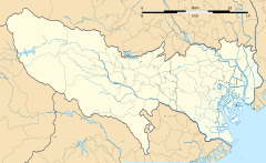 Shirokanedai Station Location within Tokyo | |||||||||||||||||||||
Shirokanedai Station (白金台駅, Shirokanedai-eki) is a subway station in Minato, Tokyo, operated jointly by the Tokyo subway operators Tokyo Metro and Tokyo Metropolitan Bureau of Transportation (Toei).
Lines[]
Shirokanedai Station is served by the Tokyo Metro Namboku Line (station number N-02) and the Toei Mita Line (station number I-02), and lies 1.3 km (0.81 mi) from the starting point of both lines at Meguro Station and a kilometer away from Shirokane-takanawa Station.[1] It is the least used station on the Toei network, with 5,070 boardings per day in 2018.[2]
Station layout[]
The station has two underground side platforms on the fourth basement ("B4F") level, serving two tracks shared by both Tokyo Metro Namboku Line and the Toei Mita Line services.
Platforms[]
| 1 | N Tokyo Metro Namboku Line | for Akabane-iwabuchi SR Saitama Rapid Railway Line for Urawa-Misono |
| I Toei Mita Line | for Nishi-Takashimadaira | |
| 2 | N Tokyo Metro Namboku Line | for Meguro MG Tokyu Meguro Line for Hiyoshi |
| I Toei Mita Line | for Meguro MG Tokyu Meguro Line for Hiyoshi |
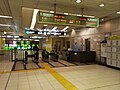
The ticket barriers in March 2016
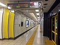
Platform 2 in October 2014


History[]
The station opened on 26 September 2000.[1]
Surrounding area[]
- Meiji Gakuin University Shirokane Campus
- Meiji Gakuin Senior High School
- Institute of Medical Science
- The Institute for Nature Study
- Matsuoka Museum
See also[]
References[]
- ^ Jump up to: a b Terada, Hirokazu (19 January 2013). データブック日本の私鉄 [Databook: Japan's Private Railways] (in Japanese). Japan: Neko Publishing. p. 216. ISBN 978-4-7770-1336-4.
- ^ "Outline of Toei Transportationpublisher=Toei Subway" (PDF). Retrieved 22 Feb 2020.
External links[]
| Wikimedia Commons has media related to Shirokanedai Station. |
- Tokyo Metro station information (in Japanese)
- Toei station information (in Japanese)
Coordinates: 35°38′16.81″N 139°43′34.76″E / 35.6380028°N 139.7263222°E

- Stations of Tokyo Metro
- Stations of Tokyo Metropolitan Bureau of Transportation
- Railway stations in Tokyo
- Railway stations in Japan opened in 2000
- Toei Mita Line
- Tokyo Metro Namboku Line
- Buildings and structures in Minato, Tokyo