Shree Antu
Shree Antu
श्रीअन्तु Antu Hill | |
|---|---|
Neighborhood | |
 Antu Pond at Shree Antu | |
 Shree Antu Location in Province | |
| Coordinates: 26°53′N 88°07′E / 26.883°N 88.117°ECoordinates: 26°53′N 88°07′E / 26.883°N 88.117°E | |
| Country | |
| Province | Province No. 1 |
| District | Ilam District |
| Municipality | Suryodaya Municipality |
| Ward No. | 4 |
| Government | |
| • Type | Ward Council |
| • Ward Chairperson | Madhusudan Lamichhane |
| Area | |
| • Total | 24.08 km2 (9.30 sq mi) |
| Population (2011) | |
| • Total | 4,981 |
| • Density | 210/km2 (540/sq mi) |
| Time zone | UTC+5:45 (Nepal Time) |
| ZIP code | 57300 |


Shree Antu is a neighborhood within Suryodaya Municipality in Ilam District in the Province No. 1 of eastern Nepal. At the time of the 2011 Nepal census it had a population of 4,981.[2]
Shree Antu is a tourist destination best known as the place to observe sunrise and also famous for tea gardens.[3]

Shree Antu Pokhari at Shree Antu town in Ilam district Nepal

Tea Garden of Illam
A view tower has been constructed atop of the Sriantu Hill situated at an altitude of 2328m from sea level.
References[]
- ^ https://www.suryodayamun.gov.np/ne/content/%E0%A4%B5%E0%A4%BE%E0%A4%B0%E0%A5%8D%E0%A4%A1-%E0%A4%A8%E0%A4%82-%E0%A5%AA
- ^ "Resource mapping of Suryodaya Municipality" (PDF). Suryodaya Municipality. Retrieved 13 April 2021.
- ^ "Places of Interest in Ilam". Retrieved February 2015.
{{cite web}}: Check date values in:|accessdate=(help)
External links[]
 Sri Antu (Nepal) travel guide from Wikivoyage
- UN map of the municipalities of Ilam District
Headquarter: Ilam | ||
| Rural Municipalities | 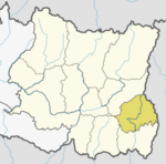 | |
| Municipalities | ||
This article about a location in Ilam District, Nepal is a stub. You can help Wikipedia by . |
Categories:
- Populated places in Ilam District
- Ilam District geography stubs