
Shrine of Remembrance, Brisbane
| Shrine of Remembrance | |
|---|---|
| Australia | |
 Shrine of Remembrance monument and the Eternal Flame Ann Street façade, Brisbane | |
| For the Australian soldiers of all wars post World War I | |
| Unveiled | 11 November 1930 |
| Location | Brisbane |
| Designed by | Buchanan and Cowper |
The Shrine of Remembrance is located in ANZAC Square, between Ann Street and Adelaide Street, in Brisbane, Queensland, Australia. With its 'Eternal Flame', the Shrine is a war memorial dedicated to the Australian and New Zealand Army Corps (Anzacs).
The Shrine of Remembrance is a major Brisbane landmark of cultural, architectural and historic importance and is a key component of the Queensland Heritage listed square[1] and annually hosts ceremonies for ANZAC Day and Armistice Day (now referred to as Remembrance Day). A service marking Singapore Day (The Fall of Singapore, 15 February 1942) is held annually on the closest Sunday to the 15th, in remembrance of the losses of the 8th Division during World War 2.
History[]


Funds were raised by public subscription for a memorial to fallen soldiers in World War I and in 1928 a competition was held for its design. The competition was won by Sydney architects Buchanan and Cowper who proposed a Greek Revival structure. The Shrine took two years to build and was dedicated on Armistice Day 11 November 1930 by Governor John Goodwin with a dedication plaque.
Architecture[]
Designed in the Greek Classic Revival style, the columns of the Shrine of Remembrance are built of Helidon sandstone, and the Eternal Flame is kept in a brass urn within the Shrine. The steps leading to the Shrine of Remembrance from ANZAC Square are made of Queensland granite. The 18 columns of the Shrine symbolise the year 1918, when hostilities ceased.
Memorial[]
There is a crypt in the lower section of the Shrine of Remembrance which contains the World War I and World War II Shrine of Memories, which contains memorial plaques to numerous Australian regiments who fought during these campaigns. There is also a World War I memorial sculpture on the Shrine of Memories external wall.
Refurbishment[]
The Lord Mayor of Brisbane, Graham Quirk, announced in the Brisbane City Council newsletter "Living in Brisbane", May edition, 2014, that, in partnership with the Queensland Government, structural repair works are being undertaken with the Shrine of Remembrance memorial.[2]
Services and ceremonies[]
Each year, on ANZAC Day, on 25 April, a Dawn memorial service is held at the Shrine of Remembrance, with wreaths being laid around the 'Eternal Flame' in memory of those who died in conflict.[3][4][5]
There is also a memorial service held each year on Remembrance Day, 11 November and wreaths are again laid at the 'Eternal Flame'.
Gallery[]

Shrine of Remembrance ANZAC Square façade, showing the lower section which contains the crypt with the World War II Shrine of Memories

Inside the Shrine of Memories

World War I Memorial Sculpture on the external wall of the Shrine of Memories section of the Shrine of Remembrance

Eternal Flame feature of the Shrine of Remembrance
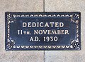
11 November 1930 dedication plaque – Shrine of Remembrance

ANZAC Square, Shrine of Remembrance at night, taken from Ann Street, Brisbane on 31 May 2012


See also[]
- ANZAC Cove, a small cove on the Gallipoli peninsula in Turkey
- ANZAC spirit, a component of modern Australasian mythology describing the spirit of mateship and cheerful suffering amongst Australians and New Zealanders
References[]
- ^ "Anzac Square (entry 600062)". Queensland Heritage Register. Queensland Heritage Council. Retrieved 13 July 2015.
- ^ "Anzac Square Reburbishment Project". Archived from the original on 22 May 2014. Retrieved 22 May 2014.
- ^ "Photo of Dawn Service on ANZAC Day, at ANZAC Square". Archived from the original on 8 November 2012. Retrieved 8 December 2008.
- ^ "Photo of Dawn Service on ANZAC Day at the Shrine of Remembrance, ANZAC Square, Adelaide Street". Archived from the original on 8 November 2012. Retrieved 8 December 2008.
- ^ "Servicemen at the Shrine of Remembrance during the Dawn service on ANZAC Day". Archived from the original on 8 November 2012. Retrieved 8 December 2008.
External links[]
| Wikimedia Commons has media related to Shrine of Remembrance, Brisbane. |
- Shrine of Remembrance – Anzac Square, Brisbane – Anzac Day War Memorials official website
- Brisbane's Anzac Square – Digger History official website
- ANZAC Square War Memorial
- Lighthorseman with wreath at the Shrine of Remembrance – Remembrance Day
- Anzac Day Commemorative Committee (Queensland) Incorporated site
- Anzac Day
- Anzac Day
- Gallipoli
- Anzac Tradition – Australian War Memorial
- Sandstone buildings in Australia
- Shrines
- Tourist attractions in Brisbane
- History of Brisbane
- World War I memorials in Queensland
- Monuments and memorials in Brisbane
- 1930 establishments in Australia
- Ann Street, Brisbane
- ANZAC (Australia)
- World War II memorials in Queensland