Si Phan Don
The Si Phan Don (Lao: ສີ່ພັນດອນ; meaning '4,000 islands') is a riverine archipelago in the Mekong River, Champasak Province in southern Laos.[1] Si Phan Don is part of Khong District, including the islands and part of the mainland in the east. Si Phan Don is dotted with numerous islands, half of which are submerged when the Mekong River is in flood. The principal islands of Si Phan Don are Don Khong (the largest), Don Som (the second largest), Don Det and Don Khon. Si Phan Don borders Cambodia and historical and cultural ties link the people on both side of the border. Pakse is the closest of the bigger cities in Laos to the area.

Key features of the Si Phan Don archipelago include:
- The remains of the first railway in Laos, the Don Det–Don Khon narrow gauge railway, built by the French to bypass the Khone Phapheng Falls and enable vessels, freight, and passengers to travel along the Mekong River.
- Freshwater Irrawaddy dolphins (pakha) that can be viewed by boat off Don Khon island. They are an endangered species.[2][3]
- The Khone Phapheng Falls, a succession of impassable rapids that gave rise to the construction of the railway.
In the past, timber was logged on the islands, but it is now regulated; illegal logging incurs stiff penalties.
While the local economies are predominantly based on agriculture, the Si Phan Don archipelago has seen an increasing number of visitors. Tourism is concentrated on Don Khong, Don Det and Don Khon. Many of the other islands are rarely visited.
Gallery[]

River bank of Don Khon with stilt wooden houses

Mekong beach near Don Loppadi
Transport of buffalos on the Mekong (from Don Det)

Six children in the Mekong with buffalos and boat

Mekong pirogue at sunset, Don Puay

Man watering cucumbers on small island

Kitchen garden on a Mekong bank, Don Loppadi
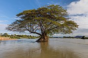
Flooded Albizia Saman (rain tree), Don Loppadi

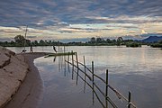
Wooden fence, Si Phan Don
Children playing at sunset on a Mekong bank, Don Loppadi

Pirogue on the Mekong under grey clouds before a storm
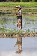
Water reflection of a smiling woman planting rice
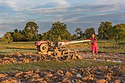
Boy plowing with a tractor at sunset in Don Det

Opaque and mirroring green paddy fields with palm tree

Two Arecaceae (palm trees) in the fields viewed through a hole in a tree stump damaged by fire in the island of Don Tao, at sunrise


References[]
- ^ "FOUR THOUSAND ISLANDS (SI PHAN DON)". Tourism Marketing Department Laos. Archived from the original on 27 October 2018. Retrieved 27 October 2018.
- ^ "Irrawaddy Dolphin". World Wildlife Fund (WWF). Retrieved 27 October 2018.
- ^ Htet Paing, Tin (2017-12-08). "Status Of Irrawaddy Dolphin Raised To 'Endangered'". The Irrawaddy. Retrieved 27 October 2018.
Coordinates: 14°02′49″N 105°49′58″E / 14.047043°N 105.832683°E

| Wikivoyage has a travel guide for Si Phan Don. |
This Laotian location article is a stub. You can help Wikipedia by . |
- Geography of Champasak province
- River islands of Laos
- Tourist attractions in Laos
- Islands of the Mekong River
- Laos geography stubs