Simpsons Gap
| Simpsons Gap | |
|---|---|
 Simpsons Gap in the West MacDonnell Ranges | |
| Location | Burt Plain, Northern Territory[1] |
| Range | MacDonnell Ranges |
| Coordinates | 23°40′32″S 133°43′07″E / 23.675655°S 133.718561°ECoordinates: 23°40′32″S 133°43′07″E / 23.675655°S 133.718561°E[1] |
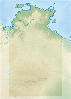 Location in the Northern Territory | |

Simpsons Gap (Arrernte: Rungutjirpa) is one of the gaps in the West MacDonnell Ranges in Australia's Northern Territory. It is located 18 kilometres west from Alice Springs, on the Larapinta Trail.[2]
The gap is home to various plants and wildlife, including the black-footed rock-wallaby. It is the site of a permanent waterhole.
History[]
The area is an important spiritual place for the Arrernte people, who have inhabited the Arrernte area since before European discovery. Simpsons Gap is known to the Arrernte as "Rungutjirpa".[3] It was later visited by surveyor Gilbert Rotherdale McMinn in 1871 while he was searching for a better route for the Overland Telegraph Line.[4]
Tourism[]
Section 1 of the Larapinta Trail begins at Alice Springs Telegraph Station and ends at the waterhole at Rungutjirpa.[5]
Gallery[]
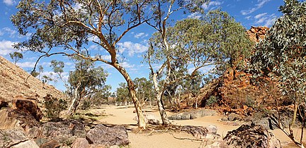
leaving Simpsons Gap
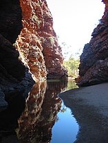
Waterhole at Rungutjirpa
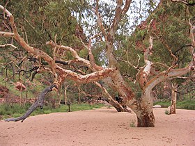
Gum at Simpsons Gap


References[]
- ^ a b "Place Names Register Extract for "Simpsons Gap"". NT Place Names Register. Northern Territory Government. Retrieved 5 April 2020.
- ^ www.macdonnellranges.com. "About Simpsons Gap Alice Springs |Where is Simpsons Gap from Alice Springs". www.macdonnellranges.com. Retrieved 2 August 2016.
- ^ "Simpsons Gap". Tourism Australia. Retrieved 5 April 2020.
- ^ "The Overland Telegraph". South Australian Register. 20 April 1871. p. 5. Retrieved 31 July 2017.
- ^ www.macdonnellranges.com. "Larapinta Trail walking itineraries and area information". www.macdonnellranges.com. Retrieved 2 August 2016.
- Canyons and gorges in the Northern Territory
- Tourist attractions in Alice Springs