Sims Chapel, Alabama
Sims Chapel, Alabama | |
|---|---|
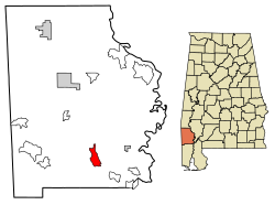 Location of Sims Chapel in Washington County, Alabama. | |
 Sims Chapel, Alabama Location of Sims Chapel in Washington County, Alabama. | |
| Coordinates: 31°13′11″N 88°08′55″W / 31.21972°N 88.14861°WCoordinates: 31°13′11″N 88°08′55″W / 31.21972°N 88.14861°W | |
| Country | United States |
| State | Alabama |
| County | Washington |
| Area | |
| • Total | 5.73 sq mi (14.85 km2) |
| • Land | 5.70 sq mi (14.77 km2) |
| • Water | 0.03 sq mi (0.08 km2) |
| Elevation | 85 ft (26 m) |
| Population (2020) | |
| • Total | 145 |
| • Density | 25.43/sq mi (9.82/km2) |
| Time zone | UTC-6 (Central (CST)) |
| • Summer (DST) | UTC-5 (CDT) |
| Area code(s) | 251 |
| GNIS feature ID | 155628[2] |

Sims Chapel (also Darrah, Grandfield) is a census-designated place and unincorporated community in Washington County, Alabama, United States. Its population was 153 as of the 2010 census.[3]
Demographics[]
| Historical population | |||
|---|---|---|---|
| Census | Pop. | %± | |
| 2020 | 145 | — | |
| U.S. Decennial Census[4] | |||
References[]
- ^ "2020 U.S. Gazetteer Files". United States Census Bureau. Retrieved October 29, 2021.
- ^ "Sims Chapel". Geographic Names Information System. United States Geological Survey.
- ^ "U.S. Census website". United States Census Bureau. Retrieved 2011-05-14.
- ^ "Census of Population and Housing". Census.gov. Retrieved June 4, 2016.
Municipalities and communities of Washington County, Alabama, United States | ||
|---|---|---|
| Towns |  | |
| CDPs | ||
| Unincorporated communities | ||
| Ghost towns | ||
| Indian reservation | ||
| Footnotes | ‡This populated place also has portions in an adjacent county or counties | |
| ||
This Washington County, Alabama state location article is a stub. You can help Wikipedia by . |
Categories:
- Census-designated places in Washington County, Alabama
- Census-designated places in Alabama
- South Alabama geography stubs