Simssee
| Simssee | |
|---|---|
 | |
 Simssee | |
| Location | Alpine foothills, Bavaria |
| Coordinates | 47°52′22″N 12°14′22″E / 47.87278°N 12.23944°ECoordinates: 47°52′22″N 12°14′22″E / 47.87278°N 12.23944°E |
| Primary inflows | , , Weidmoos-Graben |
| Primary outflows | Sims |
| Basin countries | Germany |
| Surface area | 6.5 km2 (2.5 sq mi) |
| Average depth | 13.41 m (44.0 ft) |
| Max. depth | 22 m (72 ft) |
| Water volume | 8,700,000 m3 (310,000,000 cu ft) |
| Shore length1 | 14 km (8.7 mi) |
| Surface elevation | 470.1 m (1,542 ft) |
| 1 Shore length is not a well-defined measure. | |

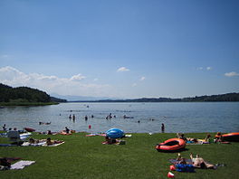
Simssee is a lake in the Alpine foothills, Bavaria, Germany. At an elevation of 470.1 m, its surface area is 6.5 km² making it the largest lake in the Rosenheim district. The maximum depth of the lake is 22.5 m. It drains into the river Sims. The retention period of the Simssee is about one and a half years and its catchment area covers 59.51 km².
It is the last remnant of Lake Rosenheim, which stretched over the area at the end of the Würm glaciation.
See also[]
- List of lakes in Bavaria
External links[]
- Nixdorf, B.; et al. (2004), "Pilsensee", Dokumentation von Zustand und Entwicklung der wichtigsten Seen Deutschlands (in German), Berlin: Umweltbundesamt, p. 67
| Authority control |
|---|
This Rosenheim district location article is a stub. You can help Wikipedia by . |
Categories:
- Lakes of Bavaria
- Rosenheim (district)
- Upper Bavaria geography stubs