Sint-Maartensdijk
Sint-Maartensdijk | |
|---|---|
Town | |
 Flag  Coat of arms | |
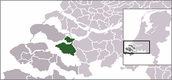 | |
 The town centre (dark green) and the statistical district (light green) of Sint-Maartensdijk in the municipality of Tholen. | |
| Coordinates: 51°32′52″N 4°4′30″E / 51.54778°N 4.07500°ECoordinates: 51°32′52″N 4°4′30″E / 51.54778°N 4.07500°E | |
| Country | Netherlands |
| Province | Zeeland |
| Municipality | Tholen |
| Area | |
| • Total | 21.86 km2 (8.44 sq mi) |
| Population (1 January 2010) | |
| • Total | 3,512 |
| • Density | 160/km2 (420/sq mi) |
| Time zone | UTC+1 (CET) |
| • Summer (DST) | UTC+2 (CEST) |

Sint-Maartensdijk is a town in the Dutch province of Zeeland. It is a part of the municipality of Tholen, and lies about 16 km west of Bergen op Zoom.
Sint-Maartensdijk was a separate municipality until 1971, when it was merged with Tholen.[1]
In 2001, the town of Sint-Maartensdijk had 3132 inhabitants. The built-up area of the town was 1.0 km², and contained 1341 residences.[2] The statistical area "Sint-Maartensdijk", which also can include the surrounding countryside, has a population of around 3650.[3]
Born in Sint-Maartensdijk[]
- Keetie van Oosten-Hage, 1949, former cyclist
- Cornelius Vermuyden, 1595, Engineer
- The Ghanaian politician Alfred Vanderpuije is descended from a Sint-Maartensdijk family
References[]
- ^ Ad van der Meer and Onno Boonstra, Repertorium van Nederlandse gemeenten, KNAW, 2011.
- ^ Statistics Netherlands (CBS), Bevolkingskernen in Nederland 2001 [1]. (Statistics are for the continuous built-up area).
- ^ Statistics Netherlands (CBS), Statline: Kerncijfers wijken en buurten 2003-2005 [2]. As of 1 January 2005.
External links[]
- J. Kuyper, Gemeente Atlas van Nederland, 1865-1870, "St Maartensdijk". Map of the former municipality, around 1868.
| hide Authority control | |
|---|---|
| General |
|
| National libraries | |
This article about a location in Zeeland is a stub. You can help Wikipedia by . |
Categories:
- Populated places in Zeeland
- Former municipalities of Zeeland
- Tholen
- Zeeland geography stubs