Smithfield, Queensland
| Smithfield Cairns, Queensland | |||||||||||||||
|---|---|---|---|---|---|---|---|---|---|---|---|---|---|---|---|
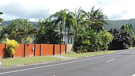 Looking west along Stanton Road, 2018 | |||||||||||||||
 Smithfield | |||||||||||||||
| Coordinates | 16°49′30″S 145°41′24″E / 16.825°S 145.69°E | ||||||||||||||
| Population | 5,303 (2016 census)[1] | ||||||||||||||
| • Density | 404.8/km2 (1,048/sq mi) | ||||||||||||||
| Established | 1876 | ||||||||||||||
| Postcode(s) | 4878 | ||||||||||||||
| Area | 13.1 km2 (5.1 sq mi) | ||||||||||||||
| Time zone | AEST (UTC+10:00) | ||||||||||||||
| Location |
| ||||||||||||||
| LGA(s) | Cairns Region | ||||||||||||||
| State electorate(s) | Barron River | ||||||||||||||
| Federal division(s) | Leichhardt | ||||||||||||||
| |||||||||||||||

Smithfield is a suburb of Cairns in the Cairns Region, Queensland, Australia.[2] In the 2016 census Smithfield had a population of 5,303 people.[1]
Geography[]
Smithfield is about 15 kilometres (9.3 mi) to the north of Cairns City, Queensland, Australia. The Captain Cook Highway passes through Smithfield and the Kuranda Range Road (the first section of the Kennedy Highway) branches from the Captain Cook Highway at Smithfield.[3]
History[]
Irukandji (also known as Yirrgay, Yurrgay, Yirrgandji, Djabuganjdji and Yirgay) is a language of Far North Queensland, particularly the area around the Kuranda Range and Lower Barron River. The Irukandji language region includes the Cairns Region.[4]
Smithfield was first established in 1876, and was a rival for dominance of the area to Cairns at that time. It was named in honour of prospector and explorer, William "Bill" Smith, who had a camp at this place.[5] On Boxing Day 1877, Bill Smith added further notoriety to the town named after him by murdering a man and then shooting himself in the main street.[6] After a devastating flooding of the Barron River on which the settlement was situated during a cyclone in March 1879, the original site was abandoned.[7]
It is now a suburb of Cairns, and is the business and trade centre of the Cairns 'Northern Beaches'.
Smithfield Provisional School opened on 7 May 1900. On 1 January 1909 it became Smithfield State School. It closed in 1964.[8]
Smithfield State High School opened on 24 January 1983.[8]
Smithfield library opened in 1998 and underwent a major refurbishment in 2008.[9]
At the 2011 census the suburb recorded a population of 3,707.[10]
In the 2016 census Smithfield had a population of 5,303 people.[1]
Education[]
Smithfield State High School is a government secondary (7-12) school for boys and girls at O'Brien Road (16°48′43″S 145°41′44″E / 16.8119°S 145.6956°E).[11][12] In 2018, the school had an enrolment of 1,122 students with 99 teachers (96 full-time equivalent) and 48 non-teaching staff (37 full-time equivalent).[13] It includes a special education program.[11][14]
There are no primary schools in Smithfield. The nearest government primary schools are Carvonica State School in neighbouring Carvonica to the south, Trinity Beach State School in neighbouring Trinity Beach to the north and Yorkeys Knob State School at neighbouring Yorkeys Knob to the east.[3]
The Cairns Campus of James Cook University is in Smithfield (16°48′58″S 145°41′12″E / 16.8162°S 145.6867°E).[15]
Facilities[]

Smithfield Police Station is at 1119 Captain Cook Highway (16°49′24″S 145°41′31″E / 16.8233°S 145.6920°E).[16]
Smithfield Fire Station is a 21 Salvado Drive (16°49′58″S 145°41′41″E / 16.8328°S 145.6947°E).[17]
Smithfield Ambulance Station is at 1 Stanton Road (16°49′54″S 145°41′33″E / 16.8318°S 145.6926°E).[16]
Smithfield Community Health Centre is at 16 Danbulan Street (16°50′15″S 145°41′44″E / 16.8376°S 145.6956°E).[15][18]
The Animal Protection Society is at 233-239 Mcgregor Road (16°49′24″S 145°42′22″E / 16.8232°S 145.7062°E).[19][20]
Amenities[]

Cairns Regional Council operates a library at 70 Cheviot Street (16°48′53″S 145°41′39″E / 16.8148°S 145.6943°E).[21]
The Smithfield branch of the Queensland Country Women's Association meets at the CWA Hall on Kamerunga Road, Caravonica (16°51′05″S 145°41′44″E / 16.8514°S 145.6955°E). It is between the Caravonica State School and the Australian Armour and Artillery Museum.[22]
Smithfield Shopping Centre is at 150 Captain Cook Highway (16°50′10″S 145°41′31″E / 16.8362°S 145.6920°E).[23] The Smithfield Post Office is within the shopping centre (16°50′09″S 145°41′31″E / 16.8359°S 145.6920°E).[24][25]
Northern Cairns Uniting Church is at 47 Cheviot Street (16°49′03″S 145°41′37″E / 16.8176°S 145.6937°E).[24][26][27]
On Leisure Park Road, there are a number of community facilities including Marlin Coast Recreation Centre (16°48′52″S 145°41′44″E / 16.8144°S 145.6955°E), Marlin Coast Swiimming and Fitness Centre (16°48′52″S 145°41′44″E / 16.8144°S 145.6956°E), North Queensland Surf Lifesaving (16°48′58″S 145°41′49″E / 16.8161°S 145.6970°E), and Ivanhoes Rugby League Club (16°48′55″S 145°41′52″E / 16.8153°S 145.6977°E).[23]
Campus Village is a shopping centre on Faculty Close (16°49′15″S 145°41′40″E / 16.8207°S 145.6944°E) across the Captain Cook Highway from the James Cook University campus.[28][29]
Attractions[]

The lower terminal of the Skyrail Rainforest Cableway is at 6 Skyrail Drive (16°50′52″S 145°41′41″E / 16.8478°S 145.6947°E).[30][31] The cableway takes visitors through the rainforest of the Barron Gorge National Park to Kuranda at the top of the Great Dividing Range.[32]
Tjapukai Aboriginal Cultural Park was at 4 Skyrail Drive (16°50′58″S 145°41′34″E / 16.8494°S 145.6928°E). The park demonstrated the authentic culture and traditions of the local Djabugay people.[15] The Tjapukai park closed down in January 2021.[33]

The Australian Armour and Artillery Museum is at 2 Skyrail Drive (16°51′01″S 145°41′43″E / 16.8502°S 145.6952°E).[34] It claims to have the largest collection of armoured vehicles and artillery in the Southern Hemisphere.[35]
References[]
- ^ a b c Australian Bureau of Statistics (27 June 2017). "Smithfield (SSC)". 2016 Census QuickStats. Retrieved 20 October 2018.

- ^ "Smithfield – suburb in Cairns Region (entry 50294)". Queensland Place Names. Queensland Government. Retrieved 28 November 2020.
- ^ a b "Queensland Globe". State of Queensland. Retrieved 28 November 2020.
- ^
 This Wikipedia article incorporates CC-BY-4.0 licensed text from: "Queensland Aboriginal and Torres Strait Islander languages map". State Library of Queensland. State Library of Queensland. Retrieved 30 January 2020.
- ^ "The New Township, Barron River. Trinity Bay". The Brisbane Courier. XXXI (2, 995). Queensland, Australia. 25 December 1876. p. 3. Archived from the original on 28 November 2020. Retrieved 14 September 2018 – via National Library of Australia.
- ^ "The Murder and Suicide at Smithfield". The Queenslander. XII (126). Queensland, Australia. 12 January 1878. p. 34. Archived from the original on 28 November 2020. Retrieved 14 September 2018 – via National Library of Australia.
- ^ Lack, Clem Llewellyn (1 January 1971), The town that was drowned : some North Queensland memories and anecdotes, Royal Historical Society of Queensland, p. 234, archived from the original on 28 November 2020, retrieved 28 November 2020
- ^ a b "Opening and closing dates of Queensland Schools". Queensland Government. Retrieved 18 April 2019.
- ^ "Public Libraries Statistical Bulletin 2016-17" (PDF). Public Libraries Connect. State Library of Queensland. November 2017. p. 12. Archived (PDF) from the original on 30 January 2018. Retrieved 19 January 2018.
- ^ Australian Bureau of Statistics (31 October 2012). "Smithfield (State Suburb)". 2011 Census QuickStats. Retrieved 6 September 2014.
- ^ a b "State and non-state school details". Queensland Government. 9 July 2018. Archived from the original on 21 November 2018. Retrieved 21 November 2018.
- ^ "Tropical North Learning Academy - Smithfield State High School". Archived from the original on 28 November 2020. Retrieved 21 November 2018.
- ^ "ACARA School Profile 2018". Australian Curriculum, Assessment and Reporting Authority. Archived from the original on 27 August 2020. Retrieved 28 January 2020.
- ^ "Tropical North Learning Academy - Smithfield SHS - Special Education Program". Archived from the original on 28 November 2020. Retrieved 21 November 2018.
- ^ a b c "Landmark Areas - Queensland". Queensland Open Data. Queensland Government. 18 November 2020. Archived from the original on 21 November 2020. Retrieved 21 October 2020.
- ^ a b "Emergency services facilities - Queensland". Queensland Open Data. Queensland Government. 18 November 2020. Archived from the original on 24 November 2020. Retrieved 24 November 2020.
- ^ "Far Northern Region". Queensland Fire and Emergency Services. Archived from the original on 28 November 2020. Retrieved 28 November 2020.
- ^ "Smithfield Community Health Centre". Queensland Health. Archived from the original on 28 November 2020. Retrieved 28 November 2020.
- ^ "Building points - Queensland". Queensland Open Data. Queensland Government. 17 November 2020. Archived from the original on 25 November 2020. Retrieved 25 November 2020.
- ^ "Home". Yaps. Archived from the original on 28 November 2020. Retrieved 28 November 2020.
- ^ "Smithfield Library". Public Libraries Connect. State Library of Queensland. 25 March 2015. Archived from the original on 19 January 2018. Retrieved 19 January 2018.
- ^ "Branch Locations". Queensland Country Women's Association. Archived from the original on 26 December 2018. Retrieved 26 December 2018.
- ^ a b "Building areas - Queensland". Queensland Open Data. Queensland Government. 17 November 2020. Archived from the original on 17 November 2020. Retrieved 17 November 2020.
- ^ a b "Community facilities - Queensland". Queensland Open Data. Queensland Government. 22 October 2020. Archived from the original on 23 October 2020. Retrieved 23 October 2020.
- ^ "Smithfield LPO". Australia Post. Retrieved 28 November 2020.
- ^ "Northern Cairns Uniting Church". Churches Australia. Archived from the original on 28 November 2020. Retrieved 28 November 2020.
- ^ "North Church Cairns". Archived from the original on 28 November 2020. Retrieved 28 November 2020.
- ^ "Building points - Queensland". Queensland Open Data. Queensland Government. 17 November 2020. Archived from the original on 25 November 2020. Retrieved 25 November 2020.
- ^ "Campus Shopping Village". Archived from the original on 28 November 2020. Retrieved 28 November 2020.
- ^ "Tourist points - Queensland". Queensland Open Data. Queensland Government. 18 November 2020. Archived from the original on 24 November 2020. Retrieved 24 November 2020.
- ^ "Aerial cableway - Queensland". Queensland Open Data. Queensland Government. 18 November 2020. Archived from the original on 24 November 2020. Retrieved 24 November 2020.
- ^ "Home". Skyrail. Archived from the original on 28 November 2020. Retrieved 28 November 2020.
- ^ Cluff, Renee; Rigby, Mark (7 January 2021). "Cairns' Tjapukai Aboriginal Cultural Park shuts for good as COVID wreaks tourism havoc". ABC Far North. Australian Broadcasting Corporation. Retrieved 4 April 2021.
- ^ "Australian Armour & Artillery Museum Cairns". Australian Armour & Artillery Museum. Archived from the original on 28 November 2020. Retrieved 28 November 2020.
- ^ "Exhibits". Australian Armour & Artillery Museum. Archived from the original on 28 November 2020. Retrieved 28 November 2020.
External links[]
| Wikimedia Commons has media related to Smithfield, Queensland. |
- "Smithfield". Queensland Places. Centre for the Government of Queensland, University of Queensland.
- Suburbs of Cairns
- 1876 establishments in Australia
- Populated places established in 1876