Smithville, Georgia
Smithville, Georgia | |
|---|---|
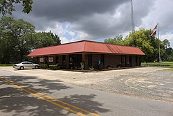 Smithville Governmental Building and Library | |
 Location in Lee County and the state of Georgia | |
| Coordinates: 31°54′7″N 84°15′19″W / 31.90194°N 84.25528°WCoordinates: 31°54′7″N 84°15′19″W / 31.90194°N 84.25528°W | |
| Country | United States |
| State | Georgia |
| County | Lee |
| Area | |
| • Total | 2.51 sq mi (6.49 km2) |
| • Land | 2.51 sq mi (6.49 km2) |
| • Water | 0.00 sq mi (0.00 km2) |
| Elevation | 328 ft (100 m) |
| Population (2010) | |
| • Total | 575 |
| • Estimate (2019)[4] | 636 |
| • Density | 253.79/sq mi (97.99/km2) |
| Time zone | UTC-5 (Eastern (EST)) |
| • Summer (DST) | UTC-4 (EDT) |
| ZIP code | 31787 |
| Area code(s) | 229 |
| FIPS code | 13-71464[2] |
| GNIS feature ID | 0356540[3] |
| Website | georgia |

Smithville is a city in Lee County, Georgia, United States. The population was 575 at the 2010 census,[5] down from 774 at the 2000 census. It is part of the Albany, Georgia Metropolitan Statistical Area.
History[]
A post office was established at Smithville in 1871.[6] The community was named after the local Smith family.[7] The Georgia General Assembly incorporated Smithville as a town in 1863.[8]
Geography[]
Smithville is located in northwestern Lee County at 31°54′7″N 84°15′19″W / 31.90194°N 84.25528°W (31.902073, -84.255336).[9] It is bordered to the north by the Sumter County line.
U.S. Route 19 runs through the west side of the city, leading south 12 miles (19 km) to Leesburg, the Lee county seat, and north 13 miles (21 km) to Americus. Georgia State Route 118 passes through the center of Smithville, leading east 12 miles (19 km) to Leslie and southwest 14 miles (23 km) to Dawson.
According to the United States Census Bureau, the city has a total area of 2.5 square miles (6.5 km2), all of it recorded as land.[10] Muckaloochee Creek forms the northeast border of the city. The creek is a south-flowing tributary of Muckalee Creek and part of the Flint River watershed.
Demographics[]
| Historical population | |||
|---|---|---|---|
| Census | Pop. | %± | |
| 1880 | 320 | — | |
| 1900 | 597 | — | |
| 1910 | 574 | −3.9% | |
| 1920 | 761 | 32.6% | |
| 1930 | 777 | 2.1% | |
| 1940 | 619 | −20.3% | |
| 1950 | 676 | 9.2% | |
| 1960 | 732 | 8.3% | |
| 1970 | 713 | −2.6% | |
| 1980 | 867 | 21.6% | |
| 1990 | 804 | −7.3% | |
| 2000 | 774 | −3.7% | |
| 2010 | 575 | −25.7% | |
| 2019 (est.) | 636 | [4] | 10.6% |
| U.S. Decennial Census[11] | |||
As of the census[2] of 2000, there were 774 people, 270 households, and 198 families residing in the city. The population density was 303.6 people per square mile (117.2/km2). There were 305 housing units at an average density of 119.6 per square mile (46.2/km2). The racial makeup of the city was 28.81% White, 70.28% African American, 0.39% from other races, and 0.52% from two or more races. Hispanic or Latino of any race were 1.03% of the population.
There were 270 households, out of which 40.4% had children under the age of 18 living with them, 40.7% were married couples living together, 27.8% had a female householder with no husband present, and 26.3% were non-families. 25.6% of all households were made up of individuals, and 10.4% had someone living alone who was 65 years of age or older. The average household size was 2.87 and the average family size was 3.44.
In the city, the population was spread out, with 33.5% under the age of 18, 10.3% from 18 to 24, 26.0% from 25 to 44, 20.7% from 45 to 64, and 9.6% who were 65 years of age or older. The median age was 30 years. For every 100 females, there were 87.0 males. For every 100 females age 18 and over, there were 86.6 males.
The median income for a household in the city was $31,500, and the median income for a family was $37,083. Males had a median income of $29,375 versus $19,286 for females. The per capita income for the city was $12,193. About 23.3% of families and 27.7% of the population were below the poverty line, including 34.8% of those under age 18 and 34.5% of those age 65 or over.
Education[]
Public schools are operated by the Lee County School District. Students are zoned to Lee County High School.
Notable people[]
- Bessie Jones (1902-1984), gospel and folk singer
- Bill McAfee (1907-1958), baseball player and mayor
- William J. Sears (1874-1944), congressman from Florida
- Jeffery Waters (1989-2019), second African American to serve as Command Master Chief of Naval Air Station Jacksonville (2016-2019)
- [[Ja'Lia Taylor]] (1989-Present) First woman to run for Mayor of Smithville. First African American to receive a PhD in Special Education from Smithville, Ga. Founder of KimRose Brown Academy and Founder of Rare Genetics by Lia Jai']]
- Hudson Woodbridge (1904-1981), aka Tampa Red, musician in Blues Hall of Fame
Gallery[]

Dismuke Public Safety Building, houses the Smithville Police Department

Smithville Post Office


References[]
- ^ "2019 U.S. Gazetteer Files". United States Census Bureau. Retrieved July 9, 2020.
- ^ Jump up to: a b "U.S. Census website". United States Census Bureau. Retrieved 2008-01-31.
- ^ "US Board on Geographic Names". United States Geological Survey. 2007-10-25. Retrieved 2008-01-31.
- ^ Jump up to: a b "Population and Housing Unit Estimates". United States Census Bureau. May 24, 2020. Retrieved May 27, 2020.
- ^ "Profile of General Population and Housing Characteristics: 2010 Census Summary File 1 (DP-1), Smithville city, Georgia". American FactFinder. U.S. Census Bureau. Archived from the original on February 13, 2020. Retrieved December 11, 2019.
- ^ "Post Offices". Jim Forte Postal History. Retrieved 10 June 2019.
- ^ Krakow, Kenneth K. (1975). Georgia Place-Names: Their History and Origins (PDF). Macon, GA: Winship Press. p. 207. ISBN 0-915430-00-2.
- ^ Candler, Allen Daniel; Evans, Clement Anselm (1906). Georgia: Comprising Sketches of Counties, Towns, Events, Institutions, and Persons Arranged in Cyclopedic Form ... State historical association. p. 328.
- ^ "US Gazetteer files: 2010, 2000, and 1990". United States Census Bureau. 2011-02-12. Retrieved 2011-04-23.
- ^ "U.S. Gazetteer Files: 2019: Places: Georgia". U.S. Census Bureau Geography Division. Retrieved December 11, 2019.
- ^ "Census of Population and Housing". Census.gov. Retrieved June 4, 2015.
External links[]
- Smithville - State of Georgia
| show Municipalities and communities of Lee County, Georgia, United States |
|---|

| show Authority control |
|---|
- Cities in Georgia (U.S. state)
- Cities in Lee County, Georgia
- Albany metropolitan area, Georgia