Somerset County Airport
Somerset County Airport | |||||||||||||||
|---|---|---|---|---|---|---|---|---|---|---|---|---|---|---|---|
| Summary | |||||||||||||||
| Airport type | Public | ||||||||||||||
| Owner | Board of County Commissioners | ||||||||||||||
| Serves | Somerset, Pennsylvania | ||||||||||||||
| Elevation AMSL | 2,275 ft / 693 m | ||||||||||||||
| Coordinates | 40°02′20″N 079°00′54″W / 40.03889°N 79.01500°WCoordinates: 40°02′20″N 079°00′54″W / 40.03889°N 79.01500°W | ||||||||||||||
| Website | co.somerset.pa.us/airport/ | ||||||||||||||
| Map | |||||||||||||||
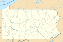
 2G9 Location of airport in Pennsylvania | |||||||||||||||
| Runways | |||||||||||||||
| |||||||||||||||
| Statistics (2011) | |||||||||||||||
| |||||||||||||||
Somerset County Airport (FAA LID: 2G9) is a county-owned public airport three miles northeast of Somerset, a borough in Somerset County, Pennsylvania.[1] The National Plan of Integrated Airport Systems for 2011–2015 categorized it as a general aviation facility.[2]
Facilities[]
The airport covers 231 acres (93 ha) at an elevation of 2,275 feet (693 m). It has two runways: 7/25 is 5,002 by 75 feet (1,525 x 23 m) asphalt; 14/32 is 2,695 by 204 feet (821 x 62 m) asphalt and turf.[1]
In the year ending October 24, 2011 the airport had 21,430 aircraft operations, average 58 per day: 86% general aviation, 12% military, and 2% air taxi. 31 aircraft were then based at the airport: 81% single-engine, 13% ultralight, and 6% multi-engine.[1]
References[]
- ^ a b c d FAA Airport Form 5010 for 2G9 PDF. Federal Aviation Administration. Effective November 15, 2012.
- ^ "2011–2015 NPIAS Report, Appendix A" (PDF, 2.03 MB). National Plan of Integrated Airport Systems. Federal Aviation Administration. October 4, 2010.
External links[]
- Somerset County Airport at Somerset County website
- Somerset County Airport (2G9) at Pennsylvania DOT Airport Directory
- Aerial image as of April 1993 from USGS The National Map
- FAA Terminal Procedures for 2G9, effective January 27, 2022
- Resources for this airport:
- FAA airport information for 2G9
- AirNav airport information for 2G9
- FlightAware airport information and live flight tracker
- SkyVector aeronautical chart for 2G9
Categories:
- Airports in Pennsylvania
- County airports in Pennsylvania
- Transportation buildings and structures in Somerset County, Pennsylvania
