Souli
Souli
Σούλι | |
|---|---|
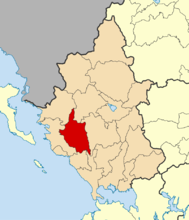 | |
 Souli show Location within the region | |
| Coordinates: 39°22′N 20°38′E / 39.367°N 20.633°ECoordinates: 39°22′N 20°38′E / 39.367°N 20.633°E | |
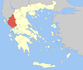
| Country | Greece |
| Administrative region | Epirus |
| Regional unit | Thesprotia |
| Area | |
| • Municipality | 502.8 km2 (194.1 sq mi) |
| • Municipal unit | 93.2 km2 (36.0 sq mi) |
| Population (2011)[1] | |
| • Municipality | 10,063 |
| • Municipality density | 20/km2 (52/sq mi) |
| • Municipal unit | 458 |
| • Municipal unit density | 4.9/km2 (13/sq mi) |
| Time zone | UTC+2 (EET) |
| • Summer (DST) | UTC+3 (EEST) |


Souli (Greek: Σούλι) is a municipality in Epirus, northwestern Greece. The seat of the municipality is the town of Paramythia.[2]
Name[]
The origin of the name Souli is uncertain. In the earliest historical text about Souli, written by Christoforos Perraivos in 1803, an oral tradition of the locals is recorded. According to this, the first settlers of Souli were shepherds who came from a village called Gardiki trying to avoid the Ottoman oppression. A certain Muslim ("Turk" in the text) named Soulis attempted to expel the early Souliotes from there but the latter resisted with arms. In the battle they killed Soulis and since then the area was named Souli.[3] Another theory suggests that the name comes from Albanian and means 'mountain summit'.
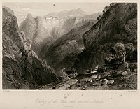
The municipality owes its name to the villages of Souli that are located in the southern part of this region. Those villages were originally settled by the Souliotes a warlike Orthodox community who sought refuge in the mountainous terrain from the Ottomans. Those villages in the early 19th century had a population of c. 12,000.[4][5][6] After their expulsion the population of the region was significantly reduced. In the 18th and 19th century, the citizens of Souli rebelled against the Ottoman rule.
Municipality[]

The present municipality of Souli was formed in the 2011 local government reform by the merger of the following 3 former municipalities, which became municipal units:[2]
- Acherontas
- Paramythia
- Souli
The municipality has an area of 502.8 km2, and the municipal unit 93.2 km2.[7]
Province[]
The province of Souli (Greek: Επαρχία Σουλίου) was one of the provinces of Thesprotia. It had the same territory as the present municipality.[8] It was abolished in 2006.
References[]
- ^ Jump up to: a b "Απογραφή Πληθυσμού - Κατοικιών 2011. ΜΟΝΙΜΟΣ Πληθυσμός" (in Greek). Hellenic Statistical Authority.
- ^ Jump up to: a b "ΦΕΚ A 87/2010, Kallikratis reform law text" (in Greek). Government Gazette.
- ^ Peraivos Christoforos, History of Souli and Parga, 1815 edition, Venice, p. 18 (pdf 34). In Greek
- ^ Vickers, Miranda. The Albanians: A Modern History. I.B. Tauris, 1999. ISBN 1-86064-541-0, p. 20.
- ^ Ruches, Pyrrhus J. Albanian Historical Folksongs, 1716-1943: A Survey of Oral Epic Poetry from Southern Albania, with Original Texts. Argonaut, 1967, p. 20.
- ^ Sakellariou, M. V. Epirus, 4000 Years of Greek History and Civilization. Ekdotikē Athēnōn, 1997, ISBN 960-213-371-6, p. 248.
- ^ "Population & housing census 2001 (incl. area and average elevation)" (PDF) (in Greek). National Statistical Service of Greece.
- ^ "Detailed census results 1991" (PDF). (39 MB) (in Greek and French)
| Wikiquote has quotations related to: Souli |
This Epirus location article is a stub. You can help Wikipedia by . |
- Populated places in Thesprotia
- Municipalities of Epirus (region)
- Provinces of Greece
- Epirus geography stubs