The largest arch of the bridge, seen from the Cowgate.
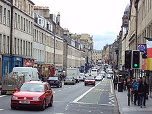
South Bridge is a road bridge and street in Edinburgh, Scotland, between the High Street and Chambers Street/Infirmary Street. It extends to North Bridge at the north and Nicolson Street at the south, forming a level roadway over the steep valley scoured parallel to the High Street when the crag and tail landscape was formed. The Cowgate roadway along the bottom of the valley runs under the largest arch of the bridge.
The South Bridge Act 1785 was passed in the House of Commons of the United Kingdom on 21 April 1785 and in 1789 taxes were raised to fund the South Bridge to a plan prepared by Robert Adam. The bridge was completed in 1788.[1] It is constructed of nineteen arches, but is almost entirely enclosed by buildings on both sides, exposing only the largest arch where the street crosses the Cowgate. Below deck level are many buildings and vaults, the latter are now something of a tourist attraction. Most of the buildings on the deck level have separate entrances (and sometimes entirely separate functions) at the level of the street passing below (the Cowgate) or parallel to the bridge (Niddry Street and Blair Street).
Initially, town plans such as John Ainslie's 1804 map showed the street name as "South Bridge Street",[2] by the 1850s the name had been shortened to "South Bridge".[3]