South Greeley, Wyoming
Parts of this article (those related to demographics) need to be updated. (April 2019) |
South Greeley | |
|---|---|
 Looking west from the Intersection of South Greeley Highway (U.S. Route 85) and College Drive in South Greeley. | |
 Location in Laramie County and the state of Wyoming. | |
 South Greeley Location in the United States | |
| Coordinates: 41°5′49″N 104°48′19″W / 41.09694°N 104.80528°WCoordinates: 41°5′49″N 104°48′19″W / 41.09694°N 104.80528°W | |
| Country | United States |
| State | Wyoming |
| County | Laramie |
| Area | |
| • Total | 1.7 sq mi (4.4 km2) |
| • Land | 1.7 sq mi (4.4 km2) |
| • Water | 0.0 sq mi (0.0 km2) |
| Elevation | 6,047 ft (1,843 m) |
| Population (2010) | |
| • Total | 4,217 |
| • Density | 2,500/sq mi (960/km2) |
| Time zone | UTC-7 (Mountain (MST)) |
| • Summer (DST) | UTC-6 (MDT) |
| Area code(s) | 307 |
| FIPS code | 56-71800[1] |
| GNIS feature ID | 1867671[2] |

South Greeley is a census-designated place (CDP) in Laramie County, Wyoming, United States. It is part of the Cheyenne, Wyoming Metropolitan Statistical Area. The population was 4,733 at the 2020 census.[3] The population was 4,217 at the 2010 census.[4]
Geography[]
South Greeley is located at 41°5′49″N 104°48′19″W / 41.09694°N 104.80528°W (41.097040, -104.805302).[5]
According to the United States Census Bureau, the CDP has a total area of 1.7 square miles (4.4 km2), all land.
Despite its name, South Greeley lies approximately 50 miles north of Greeley, Colorado.
Demographics[]
At the 2020 Census, there were 4,733 people.[3] At the 2000 census,[1] there were 4,201 people, 1,553 households and 1,091 families residing in the CDP. The population density was 2,489.6 per square mile (959.8/km2). There were 1,679 housing units at an average density of 995.0/sq mi (383.6/km2). The racial makeup of the CDP was 84.86% White, 2.31% African American, 1.50% Native American, 0.33% Asian, 7.19% from other races, and 3.81% from two or more races. Hispanic or Latino of any race were 14.90% of the population.
There were 1,553 households, of which 42.0% had children under the age of 18 living with them, 48.6% were married couples living together, 14.8% had a female householder with no husband present, and 29.7% were non-families. 22.5% of all households were made up of individuals, and 4.7% had someone living alone who was 65 years of age or older. The average household size was 2.71 and the average family size was 3.15.
32.1% of the population were under the age of 18, 10.9% from 18 to 24, 33.8% from 25 to 44, 17.8% from 45 to 64, and 5.3% who were 65 years of age or older. The median age was 29 years. For every 100 females, there were 103.3 males. For every 100 females age 18 and over, there were 101.2 males.
The median household income was $31,729 and the median family income was $34,015. Males had a median income of $28,468 vand females $19,696. The per capita income was $13,925. About 14.0% of families and 16.6% of the population were below the poverty line, including 23.4% of those under age 18 and 12.2% of those age 65 or over.
Education[]
Public education in the community of South Greeley is provided by Laramie County School District #1.
References[]
- ^ a b "U.S. Census website". United States Census Bureau. Retrieved 31 January 2008.
- ^ "US Board on Geographic Names". United States Geological Survey. 25 October 2007. Retrieved 31 January 2008.
- ^ a b eadiv.state.wy.us http://eadiv.state.wy.us/demog_data/pop2020/place_race_20.htm. Retrieved 2021-09-19.
{{cite web}}: Missing or empty|title=(help) - ^ "Profile of General Population and Housing Characteristics: 2010 Demographic Profile Data (DP-1): South Greeley CDP, Wyoming". United States Census Bureau. Retrieved 3 April 2012.
- ^ "US Gazetteer files: 2010, 2000, and 1990". United States Census Bureau. 12 February 2011. Retrieved 23 April 2011.
Municipalities and communities of Laramie County, Wyoming, United States | ||
|---|---|---|
| City | 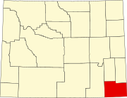 | |
| Towns | ||
| CDPs | ||
| Unincorporated communities | ||
| ||
- Census-designated places in Laramie County, Wyoming
- Census-designated places in Wyoming