Southmoor station
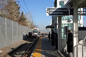 A southbound train arriving at Southmoor station. | |||||||||||||||||||
| Location | 3737 S. Monaco Parkway Denver, Colorado | ||||||||||||||||||
| Coordinates | 39°38′56″N 104°54′59″W / 39.6488°N 104.9163°WCoordinates: 39°38′56″N 104°54′59″W / 39.6488°N 104.9163°W | ||||||||||||||||||
| Owned by | Regional Transportation District | ||||||||||||||||||
| Line(s) | Southeast Corridor[1] | ||||||||||||||||||
| Platforms | 1 island platform | ||||||||||||||||||
| Connections | TheRide buses | ||||||||||||||||||
| Construction | |||||||||||||||||||
| Parking | 788 spaces[2] | ||||||||||||||||||
| Bicycle facilities | 16 racks, 22 lockers | ||||||||||||||||||
| Disabled access | Yes | ||||||||||||||||||
| Other information | |||||||||||||||||||
| Fare zone | C | ||||||||||||||||||
| History | |||||||||||||||||||
| Opened | November 17, 2006 | ||||||||||||||||||
| Services | |||||||||||||||||||
| |||||||||||||||||||

Southmoor station is an island platformed RTD light rail station in Denver, Colorado, United States. Operating as part of the E, F, and H Lines, the station was opened on November 17, 2006, and is operated by the Regional Transportation District.[3][4] It is the southernmost station before the Interstate 225 branch splits from the Southeast Corridor and serves as a transfer station for each line.[5]
The station features an interactive piece of public art entitled Harmonic Pass: Denver.[6] Created by Christopher Janney, it features a mixture of light and sound throughout the pedestrian tunnel. Within each column are photoelectric sensors and an audio speaker. Also, a riddle is etched on plaques on both ends of the tunnel. If a person can decipher the riddle and trigger the columns in the pattern described, the tunnel will “dance” a pattern of light and sound in reply.[6]
References[]
- ^ "Southeast Corridor Light Rail Line". RTD - Denver. March 2018. Retrieved 2022-02-27.
- ^ "Alphabetical park-n-Ride List". Regional Transportation District. Retrieved September 26, 2010.
- ^ Leib, Jeffrey (November 21, 2006). "A rail easy commute SE line's regular service debuts smoothly". The Denver Post. p. A1.
- ^ "RTD: Southeast Corridor" (PDF). Regional Transportation District. Archived from the original (PDF) on September 28, 2011. Retrieved September 26, 2010.
- ^ "Light rail system map". Regional Transportation District. Retrieved September 26, 2010.
- ^ a b "art-n-Transit: A rider's guide to public art on RTD's transit system, Southeast Corridor". Regional Transportation District. Retrieved September 27, 2010.
| Operators |
| ||||||||||
|---|---|---|---|---|---|---|---|---|---|---|---|
| Rail services |
| ||||||||||
| Bus services |
| ||||||||||
| Other topics | |||||||||||
This tram-, streetcar-, or light rail-related article is a stub. You can help Wikipedia by . |
This Colorado train station-related article is a stub. You can help Wikipedia by . |
This Denver-related article is a stub. You can help Wikipedia by . |
- RTD light rail stations in Denver
- Railway stations in the United States opened in 2006
- 2006 establishments in Colorado
- Tram stubs
- Colorado railway station stubs
- Denver stubs