Southside, Independence County, Arkansas
Southside, Arkansas | |
|---|---|
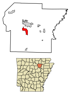 Location of Southside in Independence County, Arkansas. | |
| Country | United States |
| State | Arkansas |
| County | Independence |
| Incorporated | 2014 |
| Government | |
| Area | |
| • Total | 9.86 sq mi (25.53 km2) |
| • Land | 9.86 sq mi (25.53 km2) |
| • Water | 0.00 sq mi (0.01 km2) |
| Population (2020) | |
| • Total | 4,279 |
| • Density | 434.20/sq mi (167.64/km2) |
| Time zone | UTC-6 (CST) |
| • Summer (DST) | UTC-5 (CDT) |
| FIPS code | 05-65630 [2] |
Southside is an incorporated city located in Independence County, Arkansas, United States.
The elevation of Southside is 354 feet (108 m).[3]
The spur route of Arkansas Highway 14 connects Southside with Salado.[4]
History[]
Southside was incorporated on October 29, 2014.
Demographics[]
| Historical population | |||
|---|---|---|---|
| Census | Pop. | %± | |
| 2020 | 4,279 | — | |
| U.S. Decennial Census | |||
Education[]
Students in Southside can go to Southside School District or Batesville School District, Arkansas.
References[]
- ^ "2020 U.S. Gazetteer Files". United States Census Bureau. Retrieved October 29, 2021.
- ^ "Feature ID 68757: Township of Barren (Independence County, Arkansas)". Geographic Names Information System. United States Geological Survey. Retrieved May 31, 2014.
- ^ "Southside". Geographic Names Information System. United States Geological Survey. 30 Apr 1980. Retrieved 2009-07-11.
- ^ https://www.arkansashighways.com/maps/Counties/County%20PDFs/IndependenceCounty.pdf[dead link]
External links[]
Coordinates: 35°41.90′N 91°37.40′W / 35.69833°N 91.62333°W

Municipalities and communities of Independence County, Arkansas, United States | ||
|---|---|---|
| Cities |  | |
| Towns | ||
| CDPs | ||
| Other unincorporated communities | ||
| Footnotes | ‡This populated place also has portions in an adjacent county or counties | |
| ||
Categories:
- Cities in Arkansas
- Cities in Independence County, Arkansas
- Populated places established in 2014
- North Central Arkansas geography stubs