Spalding, Michigan
Spalding, Michigan | |
|---|---|
 U.S. Post Office in Spalding | |
 Spalding Location within the state of Michigan | |
| Coordinates: 45°41′45″N 87°30′39″W / 45.69583°N 87.51083°WCoordinates: 45°41′45″N 87°30′39″W / 45.69583°N 87.51083°W[1] | |
| Country | United States |
| State | Michigan |
| County | Menominee |
| Township | Spalding |
| Elevation | 850 ft (260 m) |
| Time zone | UTC-6 (Central (CST)) |
| • Summer (DST) | UTC-5 (CDT) |
| ZIP code(s) | 49886 |
| Area code(s) | 906 |
| GNIS feature ID | 638462[1] |

Spalding is an unincorporated community in Menominee County, Michigan, United States. Spalding is located in Spalding Township along U.S. Highway 2 (US 2) and US 41, one mile (1.6 km) northeast of Powers.[2] Spalding has a post office with ZIP code 49886.[3]
History[]
A post office called Spalding has been in operation since 1874.[4] The community was named for Jesse Spalding, of Chicago.[5]
Climate[]
This climatic region is typified by large seasonal temperature differences, with warm to hot (and often humid) summers and cold (sometimes severely cold) winters. According to the Köppen Climate Classification system, Spalding has a humid continental climate, abbreviated "Dfb" on climate maps.[6]
Photos[]

Spalding, MI Catholic Church
Pine Ave Spalding MI

Elm St Spalding MI

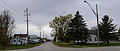
Post Office Fazers Food Land Spalding MI

References[]
- ^ a b c U.S. Geological Survey Geographic Names Information System: Spalding, Michigan
- ^ Delta County (pdf) (Map). Michigan Department of Technology, Management and Budget. 2010. Retrieved 2011-01-01.
- ^ ZIP Code Lookup, United States Post Office
- ^ "Menominee County". Jim Forte Postal History. Retrieved 29 March 2015.
- ^ Chicago and North Western Railway Company (1908). A History of the Origin of the Place Names Connected with the Chicago & North Western and Chicago, St. Paul, Minneapolis & Omaha Railways. p. 126.
- ^ Climate Summary for Spalding, Michigan
Municipalities and communities of Menominee County, Michigan, United States | ||
|---|---|---|
| Cities |  | |
| Villages | ||
| Civil townships | ||
| CDP | ||
| Other communities | ||
| Indian reservation | ||
| Footnotes | ‡This populated place also has portions in an adjacent county or counties | |
| ||
This Menominee County, Michigan location article is a stub. You can help Wikipedia by . |
- Unincorporated communities in Menominee County, Michigan
- Unincorporated communities in Michigan
- Upper Peninsula, Michigan geography stubs