Spanbroek
Spanbroek | |
|---|---|
Village | |
 | |
 Coat of arms | |
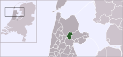 | |
 Spanbroek in the municipality of Opmeer. | |
| Coordinates: 52°41′53″N 4°57′39″E / 52.69806°N 4.96083°ECoordinates: 52°41′53″N 4°57′39″E / 52.69806°N 4.96083°E | |
| Country | Netherlands |
| Province | North Holland |
| Municipality | Opmeer |
| Population | |
| • Total | 4,000 |
| Time zone | UTC+1 (CET) |
| • Summer (DST) | UTC+2 (CEST) |

Spanbroek is a village in the Dutch province of North Holland. It is a part of the municipality of Opmeer, and lies about 9 km (6 mi) northwest of Hoorn.[1]
Spanbroek received city rights in 1414. It was a separate municipality until 1959, when it was merged with Opmeer.[2]
The Scheringa Museum of Realist Art is in Spanbroek.
References[]
- ^ ANWB Topografische Atlas Nederland, Topografische Dienst and ANWB, 2005.
- ^ Ad van der Meer and Onno Boonstra, Repertorium van Nederlandse gemeenten, KNAW, 2011.
External links[]
 Media related to Spanbroek at Wikimedia Commons
This North Holland location article is a stub. You can help Wikipedia by . |
Categories:
- Former municipalities of North Holland
- Populated places in North Holland
- Opmeer
- North Holland geography stubs