Spantekow
Spantekow | |
|---|---|
show Location of Spantekow within Vorpommern-Greifswald district | |
 Spantekow | |
| Coordinates: 53°47′N 13°32′E / 53.783°N 13.533°ECoordinates: 53°47′N 13°32′E / 53.783°N 13.533°E | |
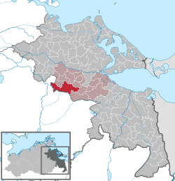
| Country | Germany |
| State | Mecklenburg-Vorpommern |
| District | Vorpommern-Greifswald |
| Municipal assoc. | Anklam-Land |
| Subdivisions | 3 |
| Government | |
| • Mayor | Gerold Klien |
| Area | |
| • Total | 70.45 km2 (27.20 sq mi) |
| Elevation | 17 m (56 ft) |
| Population (2020-12-31)[1] | |
| • Total | 1,105 |
| • Density | 16/km2 (41/sq mi) |
| Time zone | UTC+01:00 (CET) |
| • Summer (DST) | UTC+02:00 (CEST) |
| Postal codes | 17392 |
| Dialling codes | 039727 |
| Vehicle registration | VG |
| Website | www.amt-anklam-land.de |


Spantekow is a municipality in the Vorpommern-Greifswald district, in Mecklenburg-Vorpommern, Germany. It comprises the villages Dennin, Drewelow, Fasanenhof, Janow, Japenzin, Neuendorf B, Rehberg, Rebelow and Spantekow.
Since the Middle Ages, Spantekow is a local administrative center and the site of a fortress. Though Spantekow castle was largely destroyed in a Brandenburgian attack in 1677, it remained a residence of the local nobility until 1945. Today, the village is seat of the Amt Anklam-Land.
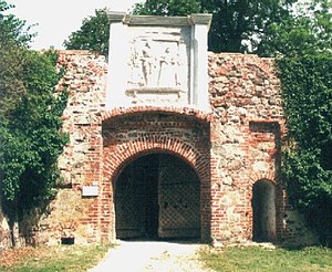
Spantekow castle, gate

Spantekow castle, palace (still in use)
References[]
- ^ "Statistisches Amt M-V – Bevölkerungsstand der Kreise, Ämter und Gemeinden 2020". Statistisches Amt Mecklenburg-Vorpommern (in German). July 2021.
| show Towns and municipalities in Vorpommern-Greifswald |
|---|
| Authority control |
|---|
This Vorpommern-Greifswald location article is a stub. You can help Wikipedia by . |
Categories:
- Municipalities in Mecklenburg-Vorpommern
- Vorpommern-Greifswald
- Province of Pomerania (1815–1945)
- Bezirk Neubrandenburg
- Vorpommern-Greifswald geography stubs