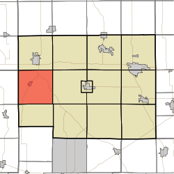
Sparta Township, Noble County, Indiana
Sparta Township | |
|---|---|
 | |
| Coordinates: 41°23′44″N 85°35′36″W / 41.39556°N 85.59333°WCoordinates: 41°23′44″N 85°35′36″W / 41.39556°N 85.59333°W | |
| Country | United States |
| State | Indiana |
| County | Noble |
| Government | |
| • Type | Indiana township |
| Area | |
| • Total | 35.24 sq mi (91.3 km2) |
| • Land | 34.95 sq mi (90.5 km2) |
| • Water | 0.3 sq mi (0.8 km2) |
| Elevation | 971 ft (296 m) |
| Population (2010) | |
| • Total | 2,924 |
| • Density | 83.7/sq mi (32.3/km2) |
| Time zone | UTC-5 (Eastern (EST)) |
| • Summer (DST) | UTC-4 (EDT) |
| Area code(s) | 260 |
| FIPS code | 18-71756[2] |
| GNIS feature ID | 453858 |

Sparta Township is one of thirteen townships in Noble County, Indiana. As of the 2010 census, its population was 2,924 and it contained 1,104 housing units.[3]
History[]
Stone's Trace was listed on the National Register of Historic Places in 1984.[4]
Geography[]
According to the 2010 census, the township has a total area of 35.24 square miles (91.3 km2), of which 34.95 square miles (90.5 km2) (or 99.18%) is land and 0.3 square miles (0.78 km2) (or 0.85%) is water.[3]
Cities and towns[]
Unincorporated towns[]
- Indian Village at 41°21′57″N 85°38′22″W / 41.3658806°N 85.6394300°W
- Kimmell at 41°23′43″N 85°32′54″W / 41.3953260°N 85.5483164°W
(This list is based on USGS data and may include former settlements.)
References[]
- ^ "US Board on Geographic Names". United States Geological Survey. 2007-10-25. Retrieved 2008-01-31.
- ^ "U.S. Census website". United States Census Bureau. Retrieved 2008-01-31.
- ^ Jump up to: a b "Population, Housing Units, Area, and Density: 2010 - County -- County Subdivision and Place -- 2010 Census Summary File 1". United States Census. Archived from the original on 2020-02-12. Retrieved 2013-05-10.
- ^ "National Register Information System". National Register of Historic Places. National Park Service. July 9, 2010.
External links[]
| show Municipalities and communities of Noble County, Indiana, United States |
|---|
| show Authority control |
|---|
This Noble County, Indiana location article is a stub. You can help Wikipedia by . |
Categories:
- Townships in Noble County, Indiana
- Townships in Indiana
- Northeast Indiana geography stubs