Splatt, Cornwall
Coordinates: 50°33′04″N 4°54′00″W / 50.551°N 4.900°W

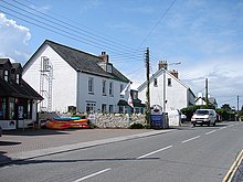
Rock Road, Splatt
Splatt is a small settlement in north Cornwall, England, United Kingdom at grid reference SW 945 763. It is situated between Pityme and Rock although the buildings along the Rock Road are continuous.[1]
It should not be confused with Splatt in the parish of Tresmeer.[2]
References[]
External links[]
![]() Media related to Splatt, Cornwall at Wikimedia Commons
Media related to Splatt, Cornwall at Wikimedia Commons
Cornwall Portal | |
| Unitary authorities | |
| Major settlements |
|
| Rivers | |
| Topics | |
This article about a location in the former district of North Cornwall, England is a stub. You can help Wikipedia by . |
Categories:
- Hamlets in Cornwall
- North Cornwall geography stubs