Spring Point Township, Cumberland County, Illinois
Spring Point Township | |
|---|---|
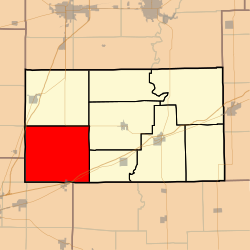 Location in Cumberland County | |
 Cumberland County's location in Illinois | |
| Coordinates: 39°14′N 88°24′W / 39.233°N 88.400°WCoordinates: 39°14′N 88°24′W / 39.233°N 88.400°W | |
| Country | |
| State | |
| County | Cumberland |
| Established | November 6, 1860 |
| Area | |
| • Total | 55.96 sq mi (144.9 km2) |
| • Land | 55.96 sq mi (144.9 km2) |
| • Water | 0 sq mi (0 km2) 0% |
| Elevation | 630 ft (192 m) |
| Population (2010) | |
| • Estimate (2016)[1] | 1,273 |
| • Density | 23.1/sq mi (8.9/km2) |
| Time zone | UTC-6 (CST) |
| • Summer (DST) | UTC-5 (CDT) |
| ZIP codes | 62436, 62445, 62447, 62462, 62467, 62468 |
| FIPS code | 17-035-72143 |

Spring Point Township is one of eight townships in Cumberland County, Illinois, USA. As of the 2010 census, its population was 1,294 and it contained 461 housing units.[2]
Geography[]
According to the 2010 U.S. census, the township has a total area of 55.96 square miles (144.9 km2), all land.[2]
Cities, towns, villages[]
- Montrose (north quarter)
Unincorporated towns[]
- Lillyville at 39°11′23″N 88°27′07″W / 39.1898°N 88.4520°W
- Roslyn at 39°13′46″N 88°22′41″W / 39.2295°N 88.3781°W
Cemeteries[]
The township contains these nine cemeteries: Brush Creek, Elliott, Faunce, Illinois Central Pioneer, Kingery, Lillyville, Mullen, Needham and Saint Rose.
Major highways[]
 Interstate 57
 Interstate 70
 U.S. Route 40
 Illinois Route 121
| Historical population | |||
|---|---|---|---|
| Census | Pop. | %± | |
| 2016 (est.) | 1,273 | [1] | |
| U.S. Decennial Census[3] | |||
School districts[]
- Cumberland Community Unit School District 77
- Dieterich Community Unit School District 30
- Neoga Community Unit School District 3
- Teutopolis Community Unit School District 50
Political districts[]
- State House District 109
- State Senate District 55
References[]
- "Spring Point Township, Cumberland County, Illinois". Geographic Names Information System. United States Geological Survey. Retrieved 2010-01-17.
- United States Census Bureau 2009 TIGER/Line Shapefiles
- United States National Atlas
- ^ a b "Population and Housing Unit Estimates". Retrieved June 9, 2017.
- ^ a b "Population, Housing Units, Area, and Density: 2010 - County -- County Subdivision and Place -- 2010 Census Summary File 1". United States Census. Archived from the original on 2020-02-12. Retrieved 2013-05-28.
- ^ "Census of Population and Housing". Census.gov. Retrieved June 4, 2016.
External links[]
Adjacent townships[]
Places adjacent to Spring Point Township, Cumberland County, Illinois | |
|---|---|
Municipalities and communities of Cumberland County, Illinois, United States | ||
|---|---|---|
| Cities | ||
| Villages | ||
| Townships | ||
| Unincorporated communities | ||
| Footnotes | ‡This populated place also has portions in an adjacent county or counties | |
| ||
This Cumberland County, Illinois location article is a stub. You can help Wikipedia by . |
Categories:
- Central Illinois geography stubs
- Townships in Cumberland County, Illinois
- Charleston–Mattoon, IL Micropolitan Statistical Area
- 1860 establishments in Illinois
- Populated places established in 1860
- Townships in Illinois