Stad (peninsula)
| Stad | |
|---|---|
| Stadlandet | |
 | |
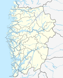 Map of Stadlandet | |
| Location | Vestland, Norway |
| Coordinates | 62°07′42″N 05°13′17″E / 62.12833°N 5.22139°ECoordinates: 62°07′42″N 05°13′17″E / 62.12833°N 5.22139°E |
| Offshore water bodies | Vanylvsfjorden, |


Stad or Stadlandet is a peninsula in Stad Municipality in the northwestern part of the Nordfjord district in Vestland county in Norway. The peninsula is considered the dividing point between the Norwegian Sea to the north and the North Sea to the south. The name is sometimes also written as Stadt, Statt, or Statlandet (not to be confused with the similar German word Stadt), because the Norwegian pronunciation of the d in this case is as a t. Some of the larger villages on the peninsula include Ervik (northwestern tip), and Leikanger (northeastern side), and the village of Selje (southwestern side).
Geography[]
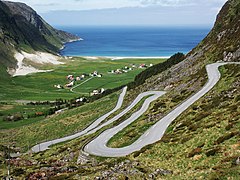
The peninsula is a 500-metre-high (1,600 ft) mountain plateau topped by the 645-metre-tall (2,116 ft) Tarvaldsegga peak. There are several lower valleys on the peninsula, but at the western end, the plateau plunges into the sea in a 497-metre-tall (1,631 ft) cliff at Kjerringa.[1]
Stad Peninsula has a very harsh, windy climate. The highest wind speed in the country is often recorded at this promontory. Located between the cities of Bergen (to the south) and Ålesund (in Møre og Romsdal county to the north), this is the only peninsula on the mainland of Norway that goes out into open sea. Most of the rest of the ship route from Bergen to Ålesund is protected by islands. The Svinøy Lighthouse (Svinøy fyr) is located 13 kilometres (8.1 mi) north of the peninsula on a small island in the Norwegian Sea.[2]
Because of the harsh climate, the peninsula can be an obstacle for ship transport along the coast of Norway. It is one of the main obstacles preventing a fast-boat passenger route from Bergen to Ålesund, a distance of 310 kilometres (190 mi; 170 nmi). Current transportation from Bergen-Ålesund is by air via Oslo, by car (7–8 hours), by bus (9 hours) or by the Hurtigruten coastal ferry (13 hours).[3]
As far back as the 1870s there were plans for the construction of a ship tunnel. A pilot project was developed in 1985, and the development company founded the same year. Plans are currently well underway to build the Stad Ship Tunnel at the narrowest point connecting the Moldefjorden to the (the innermost part of the Vanylvsfjorden) with capacity to take large ships such as the Hurtigruten vessels.[4][5][6] [7]
Media gallery[]
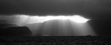
The sea at Indre Fure, in the Stad peninsula
View of the cliffs at the end of Stad

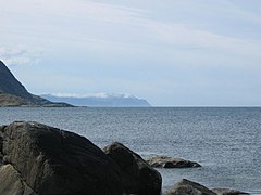
View of Fure in the distance
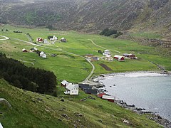
Årvik
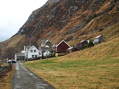
Indre Fure

Honningsvåg
Hoddevik


See also[]
References[]
- ^ Store norske leksikon. "Stad" (in Norwegian). Retrieved 2010-07-11.
- ^ Tor Wisting. "Svinøy fyr". Store norske leksikon. Retrieved April 1, 2017.
- ^ Audun Grimstad. "Hurtigruten ASA". Store norske leksikon. Retrieved April 1, 2017.
- ^ Kystverket. "Utredning av Stad skipstunnel" (in Norwegian). Retrieved 2010-07-11.
- ^ Konferanse om Stad Skipstunnel I Ålesund 4. Februar 2011 (Stad Skipstunnel)
- ^ Associated Press (6 April 2017). "Move over Suez, hello Stad – Norway to build world's first tunnel for ships". The Guardian. Retrieved 7 April 2017.
- ^ "Stad Ship Tunnel". ABC News. April 6, 2017. Retrieved April 1, 2017.
External links[]
- Selje Municipality (in Norwegian)
- Official travel guide for the Nordfjord region
- Peninsulas of Vestland
- Stad, Norway