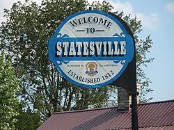
Statesville, Tennessee
Statesville, Tennessee | |
|---|---|
Unincorporated community | |
 | |
 | |
| Coordinates: 36°01′10″N 86°07′30″W / 36.01944°N 86.12500°WCoordinates: 36°01′10″N 86°07′30″W / 36.01944°N 86.12500°W | |
| Country | United States |
| State | Tennessee |
| County | Wilson |
| Elevation | 722 ft (220 m) |
| Time zone | UTC-6 (Central (CST)) |
| • Summer (DST) | UTC-5 (CDT) |
| Area code(s) | 615 |
| GNIS feature ID | 1303808[1] |

Statesville is an unincorporated community in Wilson County, Tennessee. It is located along Tennessee State Route 267 (Statesville Road) between Watertown and .
History[]
The community was first called Smith's Fork and was officially established in 1812,[2] making it the second oldest town in Wilson County. Local resident William Bumpass donated land to be divided into 19 town lots. The community was originally named "Marysville" in honor of Mary Bumpass, William's wife. In 1818 the community applied for a post office. To avoid confusion with Maryville in east Tennessee, the town's name was changed to Statesville, chosen in honor of Statesville, North Carolina, as many residents had come from that location.[3]
The post office was established on March 29, 1819, and was twice discontinued before closing in 1935. The town became prominent in 1834 when one-fourth of the state's cotton mills were located there. During that time there were seven stores, five saloons, a wood shop, three blacksmith shops, and three harness, boot, and shoe shops.[3]

Statesville United Methodist Church

Street in Statesville


Education[]
Statesville is served by Wilson County Schools.[4] Its zoned schools are Watertown Elementary School, Watertown Middle School, and Watertown High School.[5]
Notes[]
- ^ "US Board on Geographic Names". United States Geological Survey. 2007-10-25. Retrieved 2008-01-31.
- ^ History of Tennessee from the Earliest Time to the Present. Goodspeed Publishing Company. 1886. p. 856.
- ^ Jump up to: a b History of Wilson County, Tennessee - Its Land and its Life. Ed. G. Frank Burns. 238
- ^ "2020 CENSUS - SCHOOL DISTRICT REFERENCE MAP: Wilson County, TN" (PDF). U.S. Census Bureau. Retrieved 2021-07-06.
- ^ "School Zone Maps". Wilson County School District. Retrieved 2021-07-06. - See Watertown Elementary, Watertown Middle, and Watertown High School zones.
| show Municipalities and communities of Wilson County, Tennessee, United States |
|---|
| show Authority control |
|---|
This Wilson County, Tennessee geography–related article is a stub. You can help Wikipedia by . |
- Unincorporated communities in Wilson County, Tennessee
- Unincorporated communities in Tennessee
- Populated places established in 1812
- Middle Tennessee geography stubs