Steinbach am Ziehberg
Steinbach am Ziehberg | |
|---|---|
 | |
 Coat of arms | |
 Steinbach am Ziehberg Location within Austria | |
| Coordinates: 47°53′32″N 14°02′00″E / 47.89222°N 14.03333°ECoordinates: 47°53′32″N 14°02′00″E / 47.89222°N 14.03333°E | |
| Country | Austria |
| State | Upper Austria |
| District | Kirchdorf an der Krems |
| Government | |
| • Mayor | Bettina Lancaster (SPÖ) |
| Area | |
| • Total | 34.78 km2 (13.43 sq mi) |
| Elevation | 547 m (1,795 ft) |
| Population (2018-01-01)[2] | |
| • Total | 828 |
| • Density | 24/km2 (62/sq mi) |
| Time zone | UTC+1 (CET) |
| • Summer (DST) | UTC+2 (CEST) |
| Postal code | 4562 |
| Area code | 07582 |
| Vehicle registration | KI |
| Website | www.steinbach-ziehberg.at |

Steinbach am Ziehberg is a municipality in the district of Kirchdorf an der Krems in the Austrian state of Upper Austria.
Geography[]
Steinbach lies in the Traunviertel. About 65 percent of the municipality is forest, and 27 percent is farmland.

Village at state road 533

Town hall

Fire station

Village at Ziehberghöhe
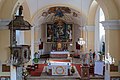
Cath. parish church Saint Florian

Summit of Pfannstein


References[]
- ^ "Dauersiedlungsraum der Gemeinden Politischen Bezirke und Bundesländer - Gebietsstand 1.1.2018". Statistics Austria. Retrieved 10 March 2019.
- ^ "Einwohnerzahl 1.1.2018 nach Gemeinden mit Status, Gebietsstand 1.1.2018". Statistics Austria. Retrieved 9 March 2019.
| Wikimedia Commons has media related to Steinbach am Ziehberg. |
| Authority control |
|---|
This Upper Austria location article is a stub. You can help Wikipedia by . |
Categories:
- Cities and towns in Kirchdorf an der Krems District
- Upper Austria geography stubs