Steinberg, Saxony
Steinberg | |
|---|---|
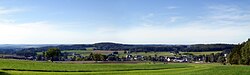 Wildenau district of Steinberg | |
 Coat of arms | |
show Location of Steinberg within Vogtlandkreis district | |
 Steinberg | |
| Coordinates: 50°32′20″N 12°28′40″E / 50.53889°N 12.47778°ECoordinates: 50°32′20″N 12°28′40″E / 50.53889°N 12.47778°E | |
| Country | Germany |
| State | Saxony |
| District | Vogtlandkreis |
| Subdivisions | 3 |
| Government | |
| • Mayor (2015–22) | Andreas Gruner[1] |
| Area | |
| • Total | 20.37 km2 (7.86 sq mi) |
| Elevation | 596 m (1,955 ft) |
| Population (2020-12-31)[2] | |
| • Total | 2,702 |
| • Density | 130/km2 (340/sq mi) |
| Time zone | UTC+01:00 (CET) |
| • Summer (DST) | UTC+02:00 (CEST) |
| Postal codes | 08237 |
| Dialling codes | 037462 |
| Vehicle registration | V, AE, OVL, PL, RC |
| Website | www.gemeinde-steinberg.de |


Steinberg is a municipality in the Vogtlandkreis district, in Saxony, Germany. It was established in 1994 by the merger of the three villages Rothenkirchen, Wernesgrün and Wildenau and named after the nearby Steinberg (661m/2168 ft), part of the Ore Mountains.
Wernesgrün is home of the Wernesgrüner brewery.
References[]
- ^ Bürgermeisterwahlen 2015, Freistaat Sachsen, accessed 13 July 2021.
- ^ "Bevölkerung des Freistaates Sachsen nach Gemeinden am 31. Dezember 2020". Statistisches Landesamt des Freistaates Sachsen (in German). June 2021.
| show Towns and municipalities in Vogtlandkreis |
|---|
| Authority control |
|---|
This Vogtlandkreis location article is a stub. You can help Wikipedia by . |
Categories:
- Municipalities in Saxony
- Vogtlandkreis
- Kingdom of Saxony
- Bezirk Karl-Marx-Stadt
- Saxony geography stubs