Stoltz Island
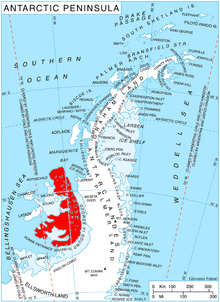
Stoltz Island (69°15′S 72°9′W / 69.250°S 72.150°WCoordinates: 69°15′S 72°9′W / 69.250°S 72.150°W) is a small island off the northwest coast of Alexander Island, Antarctica, 7 nautical miles (13 km) south of Cape Vostok and 1.09 mi (1.75 km) southwest of Buneva Point. The island was photographed from the air by the U.S. Navy, 1966, and was plotted by DOS, 1977, from the photographs and imagery of January 1974. Named by Advisory Committee on Antarctic Names (US-ACAN) for Lieutenant Commander , U.S. Navy, , , Antarctica, Operation Deepfreeze, 1970 and 1971.
 WikiMiniAtlas
See also[]
- List of Antarctic and sub-Antarctic islands
- Dint Island
- Dorsey Island
- Umber Island
![]() This article incorporates public domain material from the United States Geological Survey document: "Stoltz Island". (content from the Geographic Names Information System)
This article incorporates public domain material from the United States Geological Survey document: "Stoltz Island". (content from the Geographic Names Information System) ![]()
This Alexander Island location article is a stub. You can help Wikipedia by . |
- Islands of Alexander Island
- Alexander Island geography stubs