Strawn, Texas
Strawn, Texas | |
|---|---|
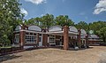
 City Hall | |
 Location of Strawn, Texas | |
 | |
| Coordinates: 32°33′2″N 98°29′53″W / 32.55056°N 98.49806°WCoordinates: 32°33′2″N 98°29′53″W / 32.55056°N 98.49806°W | |
| Country | United States |
| State | Texas |
| County | Palo Pinto |
| Area | |
| • Total | 0.79 sq mi (2.03 km2) |
| • Land | 0.78 sq mi (2.02 km2) |
| • Water | 0.01 sq mi (0.02 km2) |
| Elevation | 1,004 ft (306 m) |
| Population (2010) | |
| • Total | 653 |
| • Estimate (2019)[4] | 671 |
| • Density | 861.36/sq mi (332.77/km2) |
| Time zone | UTC-6 (Central (CST)) |
| • Summer (DST) | UTC-5 (CDT) |
| ZIP code | 76475 |
| Area code(s) | 254 |
| FIPS code | 48-70580[2] |
| GNIS feature ID | 1347995[3] |
| Website | www |

Strawn is a city in Palo Pinto County, Texas, United States. The population was 653 at the 2010 census. Strawn, on State highways 16 and 108, Farm Road 2372, and the Missouri Pacific Railroad in southwestern Palo Pinto County, was one of several towns developed about 1880 when the Texas and Pacific Railway began service. The site, known earlier as North Fork for its location on Palo Pinto Creek, was laid out on the land of two early ranchers, Stephen Bethel Strawn and James N. Stuart. Stuart built the area's first house in 1875. A community to the west, Russell's Pocket, and one to the east, Davidsonville, were merged to form Strawn.
Geography[]
According to the United States Census Bureau, the city has a total area of 0.8 square miles (2.1 km2), all of it land.
Climate[]
The climate in this area is characterized by hot, humid summers and generally mild to cool winters. According to the Köppen Climate Classification system, Strawn has a humid subtropical climate, abbreviated "Cfa" on climate maps.[5]
Demographics[]
| Historical population | |||
|---|---|---|---|
| Census | Pop. | %± | |
| 1890 | 514 | — | |
| 1920 | 2,457 | — | |
| 1930 | 1,429 | −41.8% | |
| 1940 | 1,107 | −22.5% | |
| 1950 | 922 | −16.7% | |
| 1960 | 817 | −11.4% | |
| 1970 | 786 | −3.8% | |
| 1980 | 694 | −11.7% | |
| 1990 | 709 | 2.2% | |
| 2000 | 739 | 4.2% | |
| 2010 | 653 | −11.6% | |
| 2019 (est.) | 671 | [4] | 2.8% |
| U.S. Decennial Census[6] | |||
As of the census[2] of 2000, there were 739 people, 299 households, and 194 families residing in the city. The population density was 938.1 people per square mile (361.2/km2). There were 354 housing units at an average density of 449.4 per square mile (173.0/km2). The racial makeup of the city was 81.06% White, 0.27% African American, 0.54% Native American, 0.14% Asian, 0.54% Pacific Islander, 15.56% from other races, and 1.89% from two or more races. Hispanic or Latino of any race were 24.36% of the population.
There were 299 households, out of which 33.4% had children under the age of 18 living with them, 45.2% were married couples living together, 12.0% had a female householder with no husband present, and 35.1% were non-families. 33.4% of all households were made up of individuals, and 18.4% had someone living alone who was 65 years of age or older. The average household size was 2.47 and the average family size was 3.14.
In the city, the population was spread out, with 30.0% under the age of 18, 8.5% from 18 to 24, 27.3% from 25 to 44, 18.0% from 45 to 64, and 16.1% who were 65 years of age or older. The median age was 36 years. For every 100 females, there were 97.6 males. For every 100 females age 18 and over, there were 87.3 males.
The median income for a household in the city was $26,618, and the median income for a family was $30,268. Males had a median income of $30,000 versus $17,232 for females. The per capita income for the city was $13,707. About 7.9% of families and 14.9% of the population were below the poverty line, including 12.3% of those under age 18 and 17.8% of those age 65 or over.
Education[]
The City of Strawn is served by the Strawn Independent School District.
Photo Gallery[]
Zim's Cafe

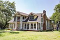
The Watson House
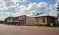
Downtown Strawn
James Nesbit Stuart House

St. John's Catholic Church

R.C. Hinkson House

Strawn Civic Center


References[]
- ^ "2019 U.S. Gazetteer Files". United States Census Bureau. Retrieved August 7, 2020.
- ^ Jump up to: a b "U.S. Census website". United States Census Bureau. Retrieved 2008-01-31.
- ^ "US Board on Geographic Names". United States Geological Survey. 2007-10-25. Retrieved 2008-01-31.
- ^ Jump up to: a b "Population and Housing Unit Estimates". United States Census Bureau. May 24, 2020. Retrieved May 27, 2020.
- ^ Climate Summary for Strawn, Texas
- ^ "Census of Population and Housing". Census.gov. Retrieved June 4, 2015.
External links[]
| Wikimedia Commons has media related to Strawn, Texas. |
| show Municipalities and communities of Palo Pinto County, Texas, United States |
|---|

| show Authority control |
|---|
- Cities in Palo Pinto County, Texas
- Cities in Texas