Stupné
Stupné | |
|---|---|
Village | |
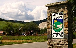 | |
 Stupné Location of Stupné in the Trenčín Region | |
| Coordinates: 49°12′N 18°26′E / 49.200°N 18.433°ECoordinates: 49°12′N 18°26′E / 49.200°N 18.433°E | |
| Country | Slovakia |
| Region | Trenčín |
| District | Považská Bystrica |
| First mentioned | 1416 |
| Area | |
| • Total | 7.52 km2 (2.90 sq mi) |
| Elevation | 340 m (1,120 ft) |
| Population | |
| • Total | 693 |
| • Density | 92/km2 (240/sq mi) |
| Postal code | 018 12 (pošta Brvnište) |
| Area code(s) | 421-42 |
| Car plate | PB |
| Website | www.obecstupne.sk |


Stupné (Hungarian: Osztopna) is a village and municipality in Považská Bystrica District in the Trenčín Region of north-western Slovakia in Považie region.
History[]
In historical records the village was first mentioned in 1416.
Geography[]
The municipality lies at an altitude of 340 metres and covers an area of 7.519 km². It has a population of about 689 people.
External links[]
![]() Media related to Stupné at Wikimedia Commons
Media related to Stupné at Wikimedia Commons
- Official website

- http://travelingluck.com/Europe/Slovakia/Slovakia+(general)/_3057382_Stupn%C3%A9.html#invest - Maps of Stupné, Weather in Stupné, sunrise and sunset in Stupné
Municipalities of Považská Bystrica District | ||
|---|---|---|
This Trenčín District location article is a stub. You can help Wikipedia by . |
Categories:
- Villages and municipalities in Považská Bystrica District
- Trenčín geography stubs