Sumbawa Regency
Sumbawa Regency
Kabupaten Sumbawa | |
|---|---|
 Coat of arms | |
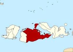 Location within West Nusa Tenggara | |
 Sumbawa Regency Location in Lesser Sunda Islands and Indonesia | |
| Coordinates: 8°44′41″S 117°40′17″E / 8.744808°S 117.671525°E | |
| Country | |
| Province | |
| Capital | Sumbawa Besar |
| Government | |
| • Regent | M. Husni Djibril |
| • Vice Regent | Mahmud Abdullah |
| Area | |
| • Total | 6,643.98 km2 (2,565.26 sq mi) |
| Population (2020 Census) | |
| • Total | 509,753 |
| • Density | 77/km2 (200/sq mi) |
| [1] | |
| Time zone | UTC+8 (ICST) |
| Area code | (+62) 371 |
| Website | sumbawakab.go.id |


Sumbawa Regency (Indonesian: Kabupaten Sumbawa) is a Regency (Kabupaten) of the Indonesian Province of West Nusa Tenggara. It is located on the island of Sumbawa and covers an area of 6,643.98 km2. It includes the substantial island of Moyo, lying off the north coast of Sumbawa. The population of the Regency at the 2010 Census was 415,789, which rose at the 2020 Census to 509,753.[2] The capital is the town of Sumbawa Besar.
Administrative districts[]
Sumbawa Regency is divided into twenty-four administrative districts (kecamatan), listed below with their areas and their populations at the 2010 Census[3][4] and the 2020 Census.[5] The table also includes the number of administrative villages (rural desa and urban kelurahan) in each district, and its postal code(s).
| District | Area in km21 |
Pop'n 2010 Census |
Pop'n 2020 Census |
No. of vill. |
Post code |
|---|---|---|---|---|---|
| Lunyuk | 513.74 | 18,109 | 22,118 | 7 | 84373 |
| Orong Telu | 465.97 | 4,584 | 5,478 | 4 | 84374 |
| Alas | 123.04 | 28,121 | 33,281 | 8 | 84353 |
| Alas Barat (Alas West) |
168.88 | 18,382 | 25,137 | 8 | 84354 |
| Buer | 137.01 | 13,621 | 16,966 | 6 | 84355 |
| Utan | 155.42 | 28,745 | 35,799 | 9 | 84351 |
| Rhee | 230.82 | 6,899 | 9,091 | 4 | 84352 |
| Batulanteh | 391.40 | 10,156 | 11,824 | 6 | 84361 |
| Sumbawa (town) (Sumbawa Besar) |
44.83 | 56,337 | 62,753 | 8 | 84311 -84318 |
| Labuhan Badas (a) | 435.89 | 29,092 | 35,427 | 7 | 84316 |
| Unter Iwes | 82.38 | 18,150 | 23,366 | 8 | 84310 |
| Moyo Hilir (Lower Moyo) |
186.79 | 22,099 | 27,961 | 10 | 84381 |
| Moyo Utara (North Moyo) |
90.80 | 9,129 | 11,509 | 6 | 84380 |
| Moyo Hulu (Upper Moyo) |
311.96 | 19,911 | 24,637 | 12 | 84371 |
| Ropang | 444.48 | 5,014 | 6,141 | 5 | 84375 |
| Lenangguar | 504.32 | 6,320 | 7,912 | 4 | 84370 |
| Lantung | 167.45 | 2,768 | 3,879 | 4 | 84372 |
| Lape | 204.43 | 16,120 | 19,928 | 4 | 84382 |
| Lopok | 155.59 | 17,564 | 21,422 | 7 | 84388 |
| Plampang | 418.69 | 27,834 | 34,453 | 11 | 84386 |
| Labangka | 243.08 | 10,212 | 13,283 | 5 | 84383 |
| Maronge | 274.75 | 9,771 | 12,007 | 4 | 84387 |
| Empang | 558.55 | 21,655 | 26,220 | 10 | 84384 |
| Tarano | 333.71 | 15,196 | 19,161 | 8 | 84385 |
| Totals | 6,643.98 | 415,789 | 509,753 | 165 |
Note: (a) Labuhan Badas District comprises the substantial island of Pulau Moyo, the smaller Pulau Medang to its west, and the small Pulau Sakonci to its northeast off the coast of the Sanggar Peninsula.
Sister Districts[]
![]() Kulim, Malaysia
Kulim, Malaysia
References[]
External links[]
| show Regencies and cities of West Nusa Tenggara |
|---|
| show Authority control |
|---|
This West Nusa Tenggara location article is a stub. You can help Wikipedia by . |
- Regencies of West Nusa Tenggara
- Sunda Islands geography stubs