West Sumbawa Regency
West Sumbawa Regency
Kabupaten Sumbawa Barat | |
|---|---|
 Coat of arms | |
| Motto(s): Pariri Lema Bariri | |
 Location within West Nusa Tenggara | |
 West Sumbawa Regency Location in Lesser Sunda Islands and Indonesia | |
| Coordinates: 8°47′14.52″S 116°55′33.2″E / 8.7873667°S 116.925889°E | |
| Country | |
| Province | |
| Capital | Taliwang |
| Government | |
| • Regent | H. W. Musyafirin, M.M |
| • Vice Regent | Fud Syaifuddin |
| Area | |
| • Total | 1,742.27 km2 (672.69 sq mi) |
| Population (2020 Census) | |
| • Total | 145,798 |
| • Density | 84/km2 (220/sq mi) |
| [1] | |
| Time zone | UTC+8 (ICST) |
| Area code | (+62) 372 |
| Website | sumbawabaratkab.go.id |


West Sumbawa Regency (Indonesian: Kabupaten Sumbawa Barat) is a Regency (Kabupaten) of the Indonesian Province of West Nusa Tenggara. It is located on the island of Sumbawa and has an area of 1,742.27 km2. The population at the 2010 Census was 114,754,[2] and at the 2020 Census was 145,798 - comprising 73,687 males and 72,111 females.[3] The capital is the town of Taliwang.


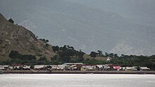
Poto Tano, the most important harbour of West Sumbawa, is easily accessible by ferry from Lombok.
Administrative Districts[]
West Sumbawa Regency consists of eight districts (kecamatan), tabulated below with their areas and their populations at the 2010 Census[4] and the 2020 Census.[5] The table also includes the number of administrative villages (rural desa and urban kelurahan) in each ditrict, and its postal codes.
| District (kecamatan) |
Area in km2 |
Population 2010 Census |
Population 2020 Census |
No. of villages |
Post code(s) |
|---|---|---|---|---|---|
| Sekongkang | 273.65 | 8,179 | 14,480 | 7 | 84457 |
| Jereweh | 527.63 | 8,370 | 9,760 | 4 | 84456 |
| Maluk | 38.83 | 11,929 | 11,650 | 5 | 84459 |
| Taliwang | 153.71 | 44,136 | 55,340 | 15 | 84452 |
| Brang Ene | 252.62 | 5,088 | 6,590 | 6 | 84455 |
| Brang Rea | 258.23 | 12,498 | 16,040 | 9 | 84455 -84458 |
| Seteluk | 107.37 | 15,424 | 19,410 | 10 | 84457 |
| Poto Tano | 130.23 | 9,327 | 12,510 | 8 | 84454 |
| Totals | 1,742.27 | 114,754 | 145,798 | 64 |
References[]
| show Regencies and cities of West Nusa Tenggara |
|---|
| show Authority control |
|---|
Coordinates: 8°47′14.52″S 116°55′33.2″E / 8.7873667°S 116.925889°E
This West Nusa Tenggara location article is a stub. You can help Wikipedia by . |
- Regencies of West Nusa Tenggara
- Sumbawa
- Sunda Islands geography stubs