Summit Township, Adair County, Iowa
Summit Township, Adair County | |
|---|---|
 | |
| Coordinates: 41°27′45″N 094°38′29″W / 41.46250°N 94.64139°WCoordinates: 41°27′45″N 094°38′29″W / 41.46250°N 94.64139°W | |
| Country | |
| State | |
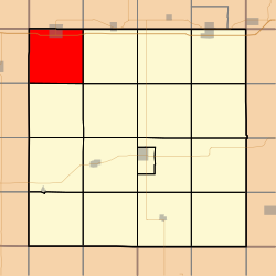
| County | Adair |
| Area | |
| • Total | 35.59 sq mi (92.18 km2) |
| • Land | 35.54 sq mi (92.04 km2) |
| • Water | 0.05 sq mi (0.14 km2) |
| Elevation | 1,375 ft (419 m) |
| Population (2010) | |
| • Total | 967 |
| • Density | 27.2/sq mi (10.5/km2) |
| Time zone | UTC-6 (CST) |
| • Summer (DST) | UTC-5 (CDT) |
| FIPS code | 19-94035[2] |
| GNIS feature ID | 0468760 |

Summit Township is one of seventeen townships in Adair County, Iowa, USA. At the 2010 census, its population was 967.[3]
History[]
Summit Township was organized in 1871. Summit is named from the ridge it contains that forms the watershed between the Mississippi and Missouri rivers.[4]
Geography[]
Summit Township covers an area of 35.59 square miles (92.2 km2) and contains one incorporated settlement, Adair. According to the USGS, it contains two cemeteries: and .
References[]
- ^ "US Board on Geographic Names". United States Geological Survey. 2007-10-25. Retrieved 2008-01-31.
- ^ "U.S. Census website". United States Census Bureau. Retrieved 2008-01-31.
- ^ "IA - Summit township". United States Census Bureau. Archived from the original on April 9, 2013. Retrieved March 17, 2013.
- ^ Kilburn, Lucian Moody (1915). History of Adair County, Iowa, and Its People, Volume 1. Pioneer Publishing Company. pp. 127–128.
External links[]
Municipalities and communities of Adair County, Iowa, United States | ||
|---|---|---|
| Cities | ||
| Townships | ||
| Unincorporated communities | ||
| Footnotes | ‡This populated place also has portions in an adjacent county or counties | |
| ||
This article about the geography of Adair County, Iowa is a stub. You can help Wikipedia by . |
Categories:
- Townships in Adair County, Iowa
- Townships in Iowa
- 1871 establishments in Iowa
- Populated places established in 1871
- South Iowa geography stubs