Sumner Township, Buchanan County, Iowa
Sumner Township, Buchanan County | |
|---|---|
 | |
| Coordinates: 42°25′25″N 091°53′40″W / 42.42361°N 91.89444°WCoordinates: 42°25′25″N 091°53′40″W / 42.42361°N 91.89444°W | |
| Country | |
| State | |
| County | Buchanan |
| Area | |
| • Total | 34.31 sq mi (88.85 km2) |
| • Land | 34.02 sq mi (88.12 km2) |
| • Water | 0.28 sq mi (0.73 km2) |
| Elevation | 932 ft (284 m) |
| Population (2000) | |
| • Total | 3,148 |
| • Density | 92.5/sq mi (35.7/km2) |
| FIPS code | 19-94047[2] |
| GNIS feature ID | 0468765 |

Sumner Township is one of sixteen townships in Buchanan County, Iowa, USA. As of the 2000 census, its population was 3,148.
Geography[]
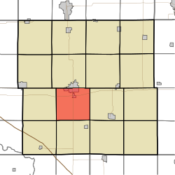
Sumner Township covers an area of 34.31 square miles (88.9 km2) and contains the southern half of the city of Independence. According to the USGS, it contains four cemeteries: Mount Hope, Oakwood, State Hospital and Wilson.
References[]
- ^ "US Board on Geographic Names". United States Geological Survey. 2007-10-25. Retrieved 2008-01-31.
- ^ "U.S. Census website". United States Census Bureau. Retrieved 2008-01-31.
External links[]
Municipalities and communities of Buchanan County, Iowa, United States | ||
|---|---|---|
| Cities | ||
| Townships | ||
| Unincorporated communities | ||
| Ghost towns | ||
| Footnotes | ‡This populated place also has portions in an adjacent county or counties | |
| ||
This article about the geography of Buchanan County, Iowa is a stub. You can help Wikipedia by . |
Categories:
- Townships in Buchanan County, Iowa
- Townships in Iowa
- Northeast Iowa geography stubs