Sunset Peak (Hong Kong)
| Sunset Peak | |
|---|---|
| 大東山 | |
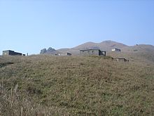
 View of Sunset Peak (2020) | |
| Highest point | |
| Elevation | 869 m (2,851 ft) Hong Kong Principal Datum |
| Coordinates | 22°15′26″N 113°57′10″E / 22.25722°N 113.95278°ECoordinates: 22°15′26″N 113°57′10″E / 22.25722°N 113.95278°E |
| Geography | |
 Sunset Peak Location of Sunset Peak in Hong Kong | |
| Location | Southern Lantau Island, Hong Kong |

Sunset Peak or Tai Tung Shan (Chinese: 大東山) is the third-highest peak in Hong Kong. It is situated on Lantau Island within Lantau South Country Park and Lantau North Country Park and stands at a height of 869 metres (2,851 ft) above sea level.[1][2][3] The second-highest Lantau Peak is located to the west of Sunset Peak.
Name[]
The Cantonese name Tai Tung Shan (Chinese: 大東山; Jyutping: Dai6 Tung1 Saan1) literally means "Big East Mountain".

Access[]
Sunset Peak is only accessible by foot. It is located on section 2 of the 70-km long Lantau Trail. Section 2 is 6.5 km long and goes from Nam Shan Campsite west of Mui Wo on South Lantau Road (altitude about 120 m), to Pak Kung Au, another campsite on the Tung Chung Road (altitude about 340 m). Both campsites are served by a number of bus routes going to Mui Wo, Tung Chung, and other destinations on Lantau island.[4]
See also[]
References[]
- ^ 地理日記:大東山 二東山 Archived 2012-08-02 at archive.today
- ^ Lands Department (February 2011). "Hong Kong Geographic Data" (PDF). Retrieved 29 April 2011.
- ^ "Ch 15 - LVIA". www.epd.gov.hk. Retrieved 4 November 2019.
- ^ Stage 2 Nam Shan to Pak Kung Au on hiking.gov.hk. The altitudes at Nam Shan and Pak Kung Au are taken from a local map.
| Wikimedia Commons has media related to Sunset Peak. |
This Hong Kong location article is a stub. You can help Wikipedia by . |
- Mountains, peaks and hills of Hong Kong
- Lantau Island
- Hong Kong geography stubs