Suwâld
show This article may be expanded with text translated from the corresponding article in Western Frisian. (December 2008) Click [show] for important translation instructions. |
Suwâld
Suawoude | |
|---|---|
Village | |
 Suwâld Church | |
 Coat of arms | |
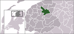
 Location of the village in Tytsjerksteradiel | |
 Suwâld Location in the Netherlands | |
| Coordinates: 53°10′40″N 5°55′35″E / 53.17778°N 5.92639°ECoordinates: 53°10′40″N 5°55′35″E / 53.17778°N 5.92639°E | |
| Country | |
| Province | |
| Municipality | |
| Population (1 January 2017) | |
| • Total | 652 |
| Time zone | UTC+1 (CET) |
| • Summer (DST) | UTC+2 (CEST) |
| Postal code | 9265 |
| Dialing code | 0511 |

Suwâld (Dutch: Suawoude) is a village in Tytsjerksteradiel municipality in the province of Friesland, the Netherlands. It had a population of around 652 in January 2017.[1]
The village has a solar powered ferry for transporting pedestrians and bicycles called Schalkediep. It travels on the from Garyp. There is no other public transport to the village.
Population[]
- 1954 - 672
- 1959 - 613
- 1964 - 616
- 1969 - 589
- 1973 - 544
- 2006 - 622
Streets[]
The West Frisian names of the streets include: Alde Lunewei (adjacent to the Alde Lune waterway), Aldemiede, Daniel Bouwes wei, De Warren (connecting to Bergum, Ds Oosterhuisstrjitte (Ds Oosterhuisstraat), Ds Pelstrjitte (Ds Pelstraat), Heechhiem, Louwsmarwei, Monnikenwei (along the north side of the canal), Mostermûne, Noarderein (Noorderend), Symen Halbes wei (connecting to De Lytse Geast), Suderein (Zuiderend), Tsjerkebuert (Kerkbuurt),.

References[]
- ^ Overzicht inwonersaantal Tytsjerksteradiel - Tytsjerksteradiel
This article needs additional citations for verification. (March 2008) |
This Friesland location article is a stub. You can help Wikipedia by . |
- Tytsjerksteradiel
- Populated places in Friesland
- Friesland geography stubs