Sycamore, Georgia
Sycamore, Georgia | |
|---|---|
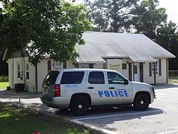 Sycamore City Hall and Police Station | |
 Location in Turner County and the state of Georgia | |
| Coordinates: 31°40′15″N 83°38′2″W / 31.67083°N 83.63389°WCoordinates: 31°40′15″N 83°38′2″W / 31.67083°N 83.63389°W | |
| Country | United States |
| State | Georgia |
| County | Turner |
| Government | |
| • Mayor | Wayne Wooddruff |
| Area | |
| • Total | 1.01 sq mi (2.62 km2) |
| • Land | 0.99 sq mi (2.56 km2) |
| • Water | 0.02 sq mi (0.06 km2) |
| Elevation | 390 ft (119 m) |
| Population (2010) | |
| • Total | 711 |
| • Estimate (2019)[4] | 664 |
| • Density | 671.39/sq mi (259.17/km2) |
| Time zone | UTC-5 (Eastern (EST)) |
| • Summer (DST) | UTC-4 (EDT) |
| ZIP code | 31790 |
| Area code(s) | 229 |
| FIPS code | 13-75104[2] |
| GNIS feature ID | 0333176[3] |
| Website | www |

Sycamore is a city in Turner County, Georgia, United States. The population was 711 at the 2010 census.
History[]
The Georgia General Assembly incorporated Sycamore as a town in 1891.[5] The community was named for the American sycamore trees near the original town site.[6]
Geography[]
Sycamore is located at 31°40′15″N 83°38′2″W / 31.67083°N 83.63389°W (31.670810, -83.633871).[7]
According to the United States Census Bureau, the city has a total area of 1.0 square mile (2.6 km2), all land.
Demographics[]
| Historical population | |||
|---|---|---|---|
| Census | Pop. | %± | |
| 1900 | 274 | — | |
| 1910 | 296 | 8.0% | |
| 1920 | 562 | 89.9% | |
| 1930 | 559 | −0.5% | |
| 1940 | 601 | 7.5% | |
| 1950 | 624 | 3.8% | |
| 1960 | 501 | −19.7% | |
| 1970 | 547 | 9.2% | |
| 1980 | 474 | −13.3% | |
| 1990 | 417 | −12.0% | |
| 2000 | 496 | 18.9% | |
| 2010 | 711 | 43.3% | |
| 2019 (est.) | 664 | [4] | −6.6% |
| U.S. Decennial Census[8] | |||
As of the census[2] of 2010, there were 711 people, 191 households, and 131 families residing in the city. The population density was 711 people per square mile (274.5/km2). There were 218 housing units at an average density of 218 per square mile (84.2/km2). The racial makeup of the city was 61.7% White, 35.9% African American, 0.6% , 1.81% from other races, and 0% from two or more races. Hispanic or Latino of any race were 2.8% of the population.
There were 191 households, out of which 29.3% had children under the age of 18 living with them, 52.9% were married couples living together, 10.5% had a female householder with no husband present, and 31.4% were non-families. 23.6% of all households were made up of individuals, and 10.8% had someone living alone who was 65 years of age or older. The average household size was 2.61 and the average family size was 3.11.
In the city, the population was spread out, with 21.2% under the age of 20, 11.4% from 10 to 24, 34.4% from 25 to 44, 22.4% from 45 to 64, and 10.5% who were 65 years of age or older. The median age was 33.3 years. For every 100 females, there were 189 males. For every 100 females age 18 and over, there were 214 males.
As of the census[2] of 2010, the median income for a household in the city was $19,063, and the median income for a family was $23,750. Males had a median income of $23,750 versus $17,143 for females. The per capita income for the city was $12,346. About 14.4% of families and 25.8% of the population were below the poverty line, including 30.3% of those under age 18 and 30.9% of those age 65 or over.
Climate[]
The climate in this area is characterized by relatively high temperatures and evenly distributed precipitation throughout the year. According to the Köppen Climate Classification system, Sycamore has a humid subtropical climate, abbreviated "Cfa" on climate maps.[9]
Notable people[]
- Clay Pirkle - Georgia House of Representatives, elected in 2015
- Thomas Creekmore- Entertainer and innovator of the “Creekmore Stomp”.
References[]
- ^ "2019 U.S. Gazetteer Files". United States Census Bureau. Retrieved July 9, 2020.
- ^ Jump up to: a b c "U.S. Census website". United States Census Bureau. Retrieved 2008-01-31.
- ^ "US Board on Geographic Names". United States Geological Survey. 2007-10-25. Retrieved 2008-01-31.
- ^ Jump up to: a b "Population and Housing Unit Estimates". United States Census Bureau. May 24, 2020. Retrieved May 27, 2020.
- ^ Acts and Resolutions of the General Assembly of the State of Georgia. Clark & Hines, State Printers. 1892. p. 817.
- ^ Krakow, Kenneth K. (1975). Georgia Place-Names: Their History and Origins (PDF). Macon, GA: Winship Press. p. 218. ISBN 0-915430-00-2.
- ^ "US Gazetteer files: 2010, 2000, and 1990". United States Census Bureau. 2011-02-12. Retrieved 2011-04-23.
- ^ "Census of Population and Housing". Census.gov. Retrieved June 4, 2015.
- ^ Climate Summary for Sycamore, Georgia
| show Municipalities and communities of Turner County, Georgia, United States |
|---|

| show Authority control |
|---|
- Cities in Georgia (U.S. state)
- Cities in Turner County, Georgia