Szentgotthárd
Szentgotthárd | |
|---|---|
 Town centre with the Rába River | |
 Flag  Coat of arms | |
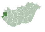
 Szentgotthárd Location of Szentgotthárd | |
| Coordinates: 46°56′56″N 16°16′45″E / 46.94876°N 16.27907°ECoordinates: 46°56′56″N 16°16′45″E / 46.94876°N 16.27907°E | |
| Country | |
| County | Vas |
| District | Szentgotthárd |
| Area | |
| • Total | 67.73 km2 (26.15 sq mi) |
| Population (2017) | |
| • Total | 8,862[1] |
| Time zone | UTC+1 (CET) |
| • Summer (DST) | UTC+2 (CEST) |
| Postal code | 9970 |
| Area code | (+36) 94 |
| Website | www |


Szentgotthárd (German: St. Gotthard; Slovene: Monošter) is the westernmost town of Hungary. It is situated on the Rába River near the Austrian border, and is home to much of Hungary's small Slovene ethnic minority.
History[]
The town took its name from, and grew up round, the Cistercian Szentgotthárd Abbey, founded here in 1183.
In 1664, it was the site of the Battle of Saint Gotthard, where an Austrian army led by Raimondo Montecuccoli defeated the Ottoman Empire so that the Turks had to agree to the Peace of Vasvár, which held until 1683.
A second Battle of Saint Gotthard in 1705 was a victory for Rákóczi's anti-Habsburg Hungarian rebels.
During World War II, Szentgotthárd was captured by Soviet troops of the 3rd Ukrainian Front on 31 March 1945 in the course of the Vienna Offensive.
Notable people[]
- Ferenc Joachim (1882–1964), painter
- Alajos Drávecz (1866–1915), Slovenian ethnologist and writer
- Ágoston Pável (1886–1946), Hungarian Slovene writer and poet, graduated here
- János Brenner (1931–1957), Roman Catholic priest, died here
- Irén Pavlics (born 1934), Hungarian Slovene author and editor
- Tibor Gécsek (born 1964), hammer thrower
- Krisztián Pars (born 1982), hammer thrower
Twin towns – sister cities[]
Szentgotthárd is twinned with:[2]
References[]
- ^ Szentgotthárd, KSH
- ^ "Testvérvárosok". szentgotthard.hu (in Hungarian). Szentgotthárd. Retrieved 2021-04-10.
External links[]
| Wikimedia Commons has media related to Szentgotthárd. |
- Official website in Hungarian, English, German and Slovenian
- Page of Opel Hungary (Szentgotthárd plant)

| show Authority control |
|---|
This Vas location article is a stub. You can help Wikipedia by . |
This Hungarian history article is a stub. You can help Wikipedia by . |
- Populated places in Vas County
- Vas geography stubs
- Hungarian history stubs