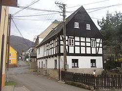
Těchlovice (Děčín District)
Těchlovice | |
|---|---|
Municipality | |
 | |
 Flag  Coat of arms | |
 Těchlovice | |
| Coordinates: 50°41′43″N 14°12′43″E / 50.69528°N 14.21194°ECoordinates: 50°41′43″N 14°12′43″E / 50.69528°N 14.21194°E | |
| Country | |
| Region | Ústí nad Labem |
| District | Děčín |
| Area | |
| • Total | 10.47 km2 (4.04 sq mi) |
| Elevation | 145 m (476 ft) |
| Population (2011) | |
| • Total | 542 |
| • Density | 52/km2 (130/sq mi) |
| Postal code | 407 12 |
| Website | http://www.sweb.cz/techlovice-obec |

Těchlovice is a village and municipality (obec) in Děčín District in the Ústí nad Labem Region of the Czech Republic.
The municipality covers an area of 10.47 square kilometres (4.04 sq mi), since 2011 the inhabitants are 542.[1]
Těchlovice lies approximately 9 kilometres (6 mi) south of Děčín, 13 km (8 mi) east of Ústí nad Labem, and 70 km (43 mi) north of Prague.
References[]
- ^ "Population of Municipalities". Czech Statistical Office. 1 January 2011. p. 12. Retrieved 7 January 2011.
| Wikimedia Commons has media related to Těchlovice (Děčín District). |
| Authority control: National libraries |
|---|
This Ústí nad Labem Region location article is a stub. You can help Wikipedia by . |
Categories:
- Villages in Děčín District
- Ústí nad Labem Region geography stubs