Tabas
Tabas
طبس | |
|---|---|
City | |
 Tabas | |
| Coordinates: 33°35′45″N 56°55′28″E / 33.59583°N 56.92444°ECoordinates: 33°35′45″N 56°55′28″E / 33.59583°N 56.92444°E | |
| Country | |
| Province | South Khorasan |
| County | Tabas |
| Bakhsh | Central |
| Elevation | 667 m (2,188 ft) |
| Population (2016 Census) | |
| • Total | 39,676 [1] |
| Time zone | UTC+3:30 (IRST) |
| • Summer (DST) | UTC+4:30 (IRDST) |

Tabas (Persian: طبس, also Romanized as Ṭabas), formerly Golshan,[2] is a city in and capital of Tabas County, South Khorasan Province, Iran.[3] At the 2011 census, its population was 35,150, in 9,903 families.[4]
Tabas is located in central Iran, 950 kilometers southeast of Tehran, in South Khorasan Province. At first, it was part of the greater Khorasan province, but in 2001, it was annexed to Yazd Province.[5] However, in 2013, it was returned to Khorasan, and it became part of South Khorasan province.[3] The name Khorasan means the land of the rising sun. There are two other places in Khorasan called Tabas, but the name Tabas usually refers to the city under discussion.
It is a desert city with many date and citrus trees. It has a 300-year-old public garden (Bagh-e-Golshan).[6] There is also a shrine in Tabas that is visited every year by thousands of pilgrims. Tabas has two universities with 2,500 to 3,500 students. The city has hot summers, and people rarely see a winter snowfall.
The people of Tabas speak a Khorasani dialect of Persian that sounds somewhat different from the standard Iranian version ("Tehrani Persian").
History[]
The history of Tabas dates back to pre-Islamic times. It was an important outpost of the Sassanid empire, and during the Arab invasion, it was considered the gateway to Khorasan. It was spared when the Mongols attacked Iran. It had a local government incorporating not only Tabas but also Ferdows and Gonabad. After the death of Nader Shah in 1747, it as under the control of the Zangu'i Arabs as an independent state which included nearby Tun.[7][8] For a time they even kidnapped Nader Mirza Afshar and placed the Kurds of Khabushan in control of Mashhad.
In 1978, the 7.4 Mw Tabas earthquake affected the city with a maximum Mercalli intensity of IX (Violent). At least 15,000 people were killed. Since then, the city has been rebuilt with many new streets, parks and public buildings.
Operation Eagle Claw[]
The failed rescue American operation Operation Eagle Claw on 24–25 April 1980 to free American hostages in Tehran occurred near Tabas. In Iran, the operation is called amaliat tabas (Tabas operation), and the significance and aftermath of the failed operation made the city Tabas known in almost every corner of Iran.[9] The Tabas air defense system is accordingly named so.
Transport[]
Multiple bus lines, a railroad station and an airport connect Tabas to Mashhad, Yazd, Tehran, Kerman and Birjand (the capital city of South Khorasan province).
Notable people[]
- Abbas Vaez-Tabasi, born 25 June 1935 in Tabas; Grand Imam and Chairman of the Astan Quds Razavi board
- Massoud Rajavi, born 18 August 1948 in Tabas; one of the two leaders of the People's Mujahedin of Iran
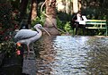
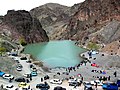
Gallery[]
References[]
- ^ "Statistical Center of Iran > Home".
- ^ Tabas can be found at GEOnet Names Server, at this link, by opening the Advanced Search box, entering "-3086556" in the "Unique Feature Id" form, and clicking on "Search Database".
- ^ a b طبس به خراسانجنوبی ملحق شد. (in Persian). ISNA. Retrieved 29 March 2013.
- ^ "Census of the Islamic Republic of Iran, 1385 (2006)" (Excel). Statistical Center of Iran. Archived from the original on 2011-11-11.
- ^ معرفی شهرستان طبس، پیشینه تاریخی (in Persian). Yazd Province Governorship. Archived from the original on 16 November 2012. Retrieved 29 March 2013.
- ^ Samira (18 January 2019). "Bagh-e-Golshan". Iran Asia. Retrieved 22 April 2021.
- ^ Malcolm, Sir John (1829). The History of Persia: From the Most Early Period to the Present Time. Murray.
- ^ Noelle-Karimi, Christine (2014). The Pearl in Its Midst: Herat and the Mapping of Khurasan (15th-19th Centuries). Austrian Academy of Sciences Press. ISBN 978-3-7001-7202-4.
- ^ fa:عملیات طبس
| Capital |
|    | |||||||||||||||||||||
|---|---|---|---|---|---|---|---|---|---|---|---|---|---|---|---|---|---|---|---|---|---|---|---|
| Counties and cities |
| ||||||||||||||||||||||
| Sights |
| ||||||||||||||||||||||
| populated places | |||||||||||||||||||||||
| Capital | |||||||||||||||||||||||||||
|---|---|---|---|---|---|---|---|---|---|---|---|---|---|---|---|---|---|---|---|---|---|---|---|---|---|---|---|
| Districts |
| ||||||||||||||||||||||||||
- Populated places in Tabas County
- Cities in South Khorasan Province
- Oases of Iran
- Cities destroyed by earthquakes