Tai Romyen National Park
| Tai Romyen National Park | |
|---|---|
 Kamin Cave | |
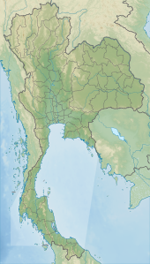 Location in Thailand | |
| Location | Surat Thani Province, Thailand |
| Nearest city | Surat Thani |
| Coordinates | 8°52′N 99°27′E / 8.867°N 99.450°ECoordinates: 8°52′N 99°27′E / 8.867°N 99.450°E |
| Area | 425 km2 (164 sq mi) |
| Established | 1991 |
| Website | Department of National Parks[1] |

Tai Romyen National Park (Thai: ใต้ร่มเย็น) is in the east of Surat Thani Province in southern Thailand. The park consists of the northern end of the Nakhon Si Thammarat mountain range and is mostly covered with forests. It was established on 31 December 1991 and covers an area of 425 km2 in the districts Kanchanadit, Ban Na San, and Wiang Sa.
The area, especially around the hill, Khao Chong Chang, was a stronghold of communist rebels in the 1980s. From here they succeeded in killing Princess Vibhavadi Rangsit in 1977 as well as the vice-governor of Surat Thani.[1] When the rebellion ceased in the early–1990s due to an amnesty program called Tai Romyen (literally, "cool shade in the south") and it was again safe to visit the area, the national park was established. The park was then named after the amnesty program.
Attractions in the park are the two waterfalls Muang Thuat and Than Thip, as well as the Khamin Cave. Also two former camps of the communist party can be visited, named Camp 180 and Camp 357.
References[]
- ^ a b "Tai Romyen National Park". Thailand National Parks. Department of National Parks, Wildlife and Plant Conservation. Archived from the original on 2 April 2015. Retrieved 12 Mar 2015.
- IUCN Category II
- Tenasserim Hills
- National parks of Thailand
- Protected areas established in 1991
- Geography of Surat Thani province
- Tourist attractions in Surat Thani province
- 1991 establishments in Thailand