Tamuning, Guam
Tamuning Tamuneng | |
|---|---|
 St. Anthony Catholic Church in Tamuning | |
 Flag | |
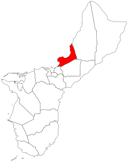 Location of Tamuning within the Territory of Guam | |
| Coordinates: 13°29′02″N 144°46′36″E / 13.48389°N 144.77667°ECoordinates: 13°29′02″N 144°46′36″E / 13.48389°N 144.77667°E | |
| Country | United States |
| Territory | Guam |
| Government | |
| • Mayor | Louise C. Rivera (R) |
| • Vice Mayor | Albert M. Toves (R) |
| Population (2010)[1] | |
| • Total | 19,685 |
| Time zone | UTC+10 (ChST) |

Tamuning, also known as Tamuning-Tumon-Harmon (Chamorro: Tamuneng) is a village located on the western shore of the United States territory of Guam. The village of Tamuning is the economic center of Guam, containing tourist center Tumon, Harmon Industrial Park, and other commercial districts. Its central location along Marine Corps Drive, the island's main thoroughfare, has aided in its development.
| Historical population | |||
|---|---|---|---|
| Census | Pop. | %± | |
| 1960 | 5,944 | — | |
| 1970 | 10,218 | 71.9% | |
| 1980 | 13,580 | 32.9% | |
| 1990 | 16,673 | 22.8% | |
| 2000 | 18,012 | 8.0% | |
| 2010 | 19,685 | 9.3% | |
| Source:[1] | |||
Tamuning is the site of the access roads and the old passenger terminal of Antonio B. Won Pat International Airport, the passenger airport for Guam.[2] Fort Juan Muña, in Harmon, is a facility for the Guam Army National Guard.
The present and former locations of Guam Memorial Hospital, Guam's only civilian and government operated hospital, are in Tamuning. With Guam's only private birthing center[3] also in the village, most modern civilian births on Guam take place in Tamuning.
Etymology[]

The ancient Chamorro word for Tamuning was Apurgan or Apotgan. "Tamuning" is a Carolinian word that was given to the area where Carolinians settled after an earthquake on January 25, 1849 near Guam caused a tsunami that devastated Lamotrek and Satawal. It is possibly the name of the clan of a Carolinian chief, though the American administration relocated the Carolinians to Saipan in the early 1900s. The area was also called Maria Christina in the 19th century.[4]
Economy[]

Beside the tourist district of Tumon, Tamuning is home to the Guam Premier Outlets, one of three major shopping centers of the island. United Airlines is headquartered in the old terminal building at Antonio B. Won Pat International Airport in Tamuning.[5][6] United Airlines, with about 1,400 jobs, is Guam's largest single employer.[7]
Demographics[]
The U.S. Census Bureau has the municipality in multiple census-designated places: Tamuning,[8] Apotgan,[9] Harmon Industrial Park,[10] Oka,[11] Tumon,[12] and Upper Tumon.[13]
Infrastructure and government[]
Government of Guam[]
The Guam Department of Land Management and the Guam Economic Development Authority have their headquarters in the Guam International Trade Center (ITC) Building in Tamuning.[14][15]
The Guam Power Authority has its headquarters in Harmon, Tamuning.[16]
The Guam Department of Mental Health and Substance Abuse has its main facility in Tamuning, across from Guam Memorial Hospital.[17][18]
U.S. federal government[]
The United States Postal Service operates the Tamuning Post Office at 143 Edward T. Calvo Memorial Parkway.[19]
Climate[]
Under the Köppen climate classification, Tamuning features a tropical rainforest climate. While the town does experience a noticeably drier season from February through April, it does not have a true dry season as all months average more than 60 mm (2.4 in) of precipitation. Tamuning averages roughly 2,300 mm (91 in) of precipitation annually, while maintaining relatively consistent temperatures throughout the course of the year.
| hideClimate data for Tamuning, Guam | |||||||||||||
|---|---|---|---|---|---|---|---|---|---|---|---|---|---|
| Month | Jan | Feb | Mar | Apr | May | Jun | Jul | Aug | Sep | Oct | Nov | Dec | Year |
| Average high °F (°C) | 85.1 (29.5) |
85.3 (29.6) |
86.1 (30.1) |
87.0 (30.6) |
87.4 (30.8) |
87.8 (31.0) |
87.2 (30.7) |
86.9 (30.5) |
86.9 (30.5) |
87.1 (30.6) |
86.8 (30.4) |
85.9 (29.9) |
86.6 (30.3) |
| Average low °F (°C) | 75.1 (23.9) |
74.6 (23.7) |
75.0 (23.9) |
76.2 (24.6) |
76.9 (24.9) |
77.1 (25.1) |
76.5 (24.7) |
76.2 (24.6) |
76.1 (24.5) |
76.4 (24.7) |
76.7 (24.8) |
76.1 (24.5) |
76.1 (24.5) |
| Average precipitation inches (mm) | 4.5 (110) |
3.5 (89) |
2.6 (66) |
3.3 (84) |
5.0 (130) |
6.3 (160) |
10.4 (260) |
14.4 (370) |
13.4 (340) |
12.2 (310) |
8.4 (210) |
5.5 (140) |
89.5 (2,270) |
| Source: Weatherbase[20] | |||||||||||||
Education[]

Primary and secondary schools[]
Public schools[]
Guam Public School System serves the island.
Public schools serving Tamuning:[21]
- Chief Brodie Memorial Elementary School (Tamuning)
- Lyndon B. Johnson Elementary School (Tamuning)
- Tamuning Elementary School (Tamuning)
- Jose L. G. Rios Middle School (Piti)
- John F. Kennedy High School (Tamuning)
Private schools[]
- St. John's School
- Saint Anthony Catholic School
Diplomacy[]

Five countries maintain consulates in Tamuning,[22] four of which are located in the landmark Guam ITC building at 590 South Marine Corps Drive.[23][24][25][26] They are:
 Micronesia (Suite 613B, ITC Building)[23]
 Japan (Suite 604A, ITC Building)[24]
 Palau (Suite 615B, ITC Building)[25]
 Philippines (Suite 601A, ITC Building)[26]
 South Korea (125C Tun Jose Camacho Street)[27]
Government[]


| Commissioner of Tamuning | ||
| Name | Term begin | Term end |
|---|---|---|
| Simon A. Sanchez | 1946 | 1948 |
| Jose P. Castro | 1948 | 1957 |
| Eugenio I. San Nicolas | 1957 | 1963 |
| Gregorio A. Calvo | 1965 | 1973 |
| Mayor of Tamuning | |||
| Name | Party | Term begin | Term end |
|---|---|---|---|
| Gregorio A. Calvo | Republican | January 1, 1973 | January 7, 1985 |
| Alfredo C. Dungca | Democratic | January 7, 1985 | January 6, 1997 |
| Luis S.N. Herrero | January 6, 1997 | January 1, 2001 | |
| Concepcion "Connie" Duenas | Republican | January 1, 2001 | January 3, 2005 |
| Francisco "Frank" C. Blas | January 3, 2005 | January 7, 2013 | |
| Louise C. Rivera | January 7, 2013 | present | |
| Vice Mayor of Tamuning | |||
| Name | Party | Term begin | Term end |
|---|---|---|---|
| Maria S.N. Leon Guerrero | Republican | January 1, 1973 | January 3, 1977 |
| Alfredo C. Dungca | January 3, 1977 | January 7, 1985 | |
| Peter S. Calvo | Democratic | January 7, 1985 | January 2, 1989 |
| Teresita C. Borja | January 2, 1989 | January 6, 1997 | |
| Concepcion M. Duenas | Republican | January 6, 1997 | January 1, 2001 |
| Nancy Leon Guerrero | January 1, 2001 | January 3, 2005 | |
| Louise C. Rivera | January 3, 2005 | January 7, 2013 | |
| Kenneth C. Santos | January 7, 2013 | October 30, 2020 | |
| Office vacant October 30, 2020 – January 4, 2021 | |||
| Albert M. Toves | Republican | January 4, 2021 | present |
See also[]
References[]
- ^ Jump up to: a b "2010 Guam Statistical Yearbook" (PDF). Archived from the original (PDF) on 2014-07-23. (4.3 MB), (rev. 2011)
- ^ "CBC66010_009.pdf." U.S. Census Bureau. Retrieved on October 6, 2010.
- ^ [1]
- ^ "Tamuning-Tumon-Harmon (Tamuneng-Tomhom)". Guampedia. Retrieved 20 May 2020.
- ^ "Docket No. SDWA-06-2005-1516." United States Environmental Protection Agency. Retrieved on February 5, 2009.
- ^ Letter Archived 2012-03-09 at the Wayback Machine. United States Department of Transportation Office of Aviation Enforcement and Proceedings. May 23, 1997. Retrieved on October 4, 2010. "Continental Micronesia Old Terminal Bldg. P.O. Box 8778-G Tamuning, GU 96931-8778."
- ^ Kerrigan, Kevin. "Guam Will Be The Pacific Hub for Merged Airlines." Pacific News Center. Wednesday May 5, 2010. Retrieved on October 5, 2010. "Continental Micronesia is Guam's single largest employer. About 14-hundred jobs here on dependant on the airline."
- ^ "2010 CENSUS - CENSUS BLOCK MAP: Tamuning CDP, GU" (PDF). U.S. Census Bureau. Retrieved 2020-10-09. - See "Tamuning muny"
- ^ "2010 CENSUS - CENSUS BLOCK MAP: Apotgan CDP, GU" (PDF). U.S. Census Bureau. Retrieved 2020-10-09.
- ^ "2010 CENSUS - CENSUS BLOCK MAP: Harmon Industrial Park CDP, GU" (PDF). U.S. Census Bureau. Retrieved 2020-10-09.
- ^ "2010 CENSUS - CENSUS BLOCK MAP: Oka CDP, GU" (PDF). U.S. Census Bureau. Retrieved 2020-10-09.
- ^ "2010 CENSUS - CENSUS BLOCK MAP (INDEX): Tumon CDP, GU" (PDF). U.S. Census Bureau. Retrieved 2020-10-09. - 1 and 2, and 3.
- ^ "2010 CENSUS - CENSUS BLOCK MAP: Upper Tumon CDP, GU" (PDF). U.S. Census Bureau. Retrieved 2020-10-09.
- ^ "DLM%20Contact%20Info.pdf Archived 2011-07-21 at the Wayback Machine." Guam Department of Land Management. Retrieved on October 21, 2010. "Street Address: 590 S. Marine Corps Drive Suite 733, ITC Building, Tamuning, GU 96913"
- ^ http://www.investguam.com/
- ^ "Grants and Resources." Environmental Protection Agency. Retrieved on October 13, 2010. "1911 Route 16 Harmon, GU 96911."
- ^ "About DMHSA Archived 2010-09-25 at the Wayback Machine." Guam Department of Mental Health and Substance Abuse. Retrieved on October 21, 2010.
- ^ "Facilities Archived 2010-07-28 at the Wayback Machine." Guam Department of Mental Health and Substance Abuse. Retrieved on October 21, 2010. "DMHSA Facility ( Click here to view Location Map ) Location : 790 Gov. Camacho Road, Tamuning, Guam 96913." Map Archived 2011-07-21 at the Wayback Machine.
- ^ "Post Office Location - TAMUNING." United States Postal Service. Retrieved on December 4, 2008.
- ^ "Weatherbase: Historical Weather for Tamuning, Guam". Weatherbase. 2011. Retrieved on November 24, 2011.
- ^ https://web.archive.org/web/20060222192437/http://www.lk4kids.com/school+links.htm
- ^ Guam Phone Book
- ^ Jump up to: a b "Federated States of Micronesia Consulates in the USA." Embassy of the Federated States of Micronesia, Washington, DC. Retrieved on December 4, 2008.
- ^ Jump up to: a b Home page. Consulate-General of Japan in Hagatna. Retrieved on December 4, 2008.
- ^ Jump up to: a b "Palau - U.S. Consulates and Overseas Missions." Embassy of the Republic of Palau, Washington, DC. Retrieved on December 4, 2008.
- ^ Jump up to: a b Home page. Consulate-General of the Philippines in Agana, Guam. Retrieved on December 4, 2008.
- ^ "총영사관 소개." Embassy of the Republic of Korea in the United States of America. Retrieved on December 4, 2008.
External links[]
| Wikimedia Commons has media related to Tamuning, Guam. |
| show Authority control |
|---|
- Villages in Guam
- Tamuning, Guam