Tarapoto
This article needs additional citations for verification. (December 2008) |
Tarapoto | |
|---|---|
Town | |
    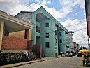  A collage of some places in Tarapoto | |
 Flag | |
| Nickname(s): City of Palms | |
 Tarapoto Location of in Peru | |
| Coordinates: 6°29′S 76°22′W / 6.483°S 76.367°W | |
| Country | |
| Region | San Martín |
| Province | San Martín |
| District | Tarapoto |
| Founded | 20 August 1782 |
| Government | |
| • Mayor | Tedy Del Águila Gronerth (2019-2022) |
| Area | |
| • Total | 15 km2 (6 sq mi) |
| Elevation | 356 m (1,168 ft) |
| Population (2017)[1] | |
| • Total | 180,073 |
| • Density | 12,000/km2 (31,000/sq mi) |
| Demonyms | Tarapotino (a) |

Tarapoto is a commercial hub town in the San Martín Province of the Department of San Martín of northern Peru.[2] It is an hour by plane from Lima, in the high jungle plateau to the east of what is known as the selva baja (low jungle). Although Moyobamba is the capital of the region, Tarapoto is the region's largest city and is linked to the Upper Amazon and the historic city of Yurimaguas by a relatively well-maintained transandean highway, paved in 2008–9.[3]
Tarapoto is approximately 356 metres (1,168 ft) above sea level on the high jungle plateau, also called the cloud forest.[4] It was founded in 1782 by Baltazar Martínez Jiménez de Compagnon.[5] According to the 2017 census Tarapoto has a population of 180,073 within the city limits, and over 130,000 inhabitants including the outlying Morales and Banda de Shilcayo districts.
Tarapoto is often used by tourists and local visitors as a base for excursions into the vast Amazon Rainforest. The region's main activities are tourism, commerce, agriculture, and an illicit "shadow economy" that includes production of coca leaves, extraction of lumber, and trading in land concessions.
Tarapoto is home to the Universidad Nacional de San Martín, an important center of higher education serving the professional and technical needs of a region of high biodiversity.[6] With its active nightlife, Tarapoto offers a wide variety of hotels and restaurants in and around the city. Moreover, the area's beautiful landscapes, waterfalls and lagoons form a tempting location for adventure tourism, such as river rafting and hiking in the tropical Andes, and attract numerous visitors to the "City of Palms".
History[]

Tarapoto was founded on August 20, 1782 by the Spanish bishop Baltazar Jaime Martínez de Compagnon y Bujanda. Its beginnings date back to the explorations of the Pocras and Chancas (old cultures of the Ayacucho region) who, when being conquered by the Inca Empire, headed a revolution led by the commander Ancohallo; a revolt that, when defeated, forced their tribal members to escape from terrible Inca vengeance.
Eventually settling down in the valleys of the Mayo and Cumbaza rivers, in what is now the Department of San Martín, they possibly formed the town of Lamas, before establishing a satellite in the valley of the rivers Cumbaza and Shilcayo, having as a central nucleus the Suchiche Lagoon (dried up in the colony). In this lagoon grew abundant Taraputus palms, a name that the Spanish bishop would later use when founding the city in this area of hunters and fishermen.
Founded September 14, 1906, Tarapoto is the main tourist and commercial hub of this part of northeastern Peru.
The city is located in the valleys of the Cumbaza and Shilcayo rivers, and is the center of the terrestrial networks and areas between the mountains, the coast and eastern Peru.
Climate[]
Tarapoto experiences a warm equatorial climate that is a tropical rainforest climate (Af) under the Köppen climate classification, more subject to the Intertropical Convergence Zone than the trade winds and with no cyclones. There is constant rainfall throughout the year, however there is a short dry season between June and September. Temperatures range from 21 to 33 °C (70 to 91 °F). The annual average temperature is 25.7 °C (78.3 °F). The average rainfall in Tarapoto is 1,162.2 millimetres (45.8 in) per year. Because the seasons are not sensitive in the equatorial zone, Tarapoto has only two seasons.
The rainy summer arrives in October and ends in June. March and April have the heaviest rains and humidity, with precipitation between 135 and 137 millimetres (5 and 5 in), respectively. In May, the Amazon River, one of the rivers surrounding the city, reaches its highest levels. It falls around 9 to 12 metres (30 to 39 ft) at its lowest point in October, and then steadily rises again cyclically according to rainfall.[7]
Winter offers a drier, sunnier climate. Although June and July are the driest months, they have some periods of downpours. Sunny days and good weather are common, with high temperatures reaching 30 °C (86 °F) and an average of 32 °C (90 °F).
| hideClimate data for Tarapoto (1961–1990, extremes 1950–present) | |||||||||||||
|---|---|---|---|---|---|---|---|---|---|---|---|---|---|
| Month | Jan | Feb | Mar | Apr | May | Jun | Jul | Aug | Sep | Oct | Nov | Dec | Year |
| Record high °C (°F) | 38.6 (101.5) |
40.0 (104.0) |
38.8 (101.8) |
38.0 (100.4) |
38.0 (100.4) |
36.0 (96.8) |
36.0 (96.8) |
37.8 (100.0) |
39.0 (102.2) |
38.5 (101.3) |
38.3 (100.9) |
38.0 (100.4) |
40.0 (104.0) |
| Average high °C (°F) | 32.9 (91.2) |
32.5 (90.5) |
32.0 (89.6) |
31.8 (89.2) |
31.8 (89.2) |
31.6 (88.9) |
31.6 (88.9) |
32.9 (91.2) |
32.6 (90.7) |
32.7 (90.9) |
32.9 (91.2) |
33.1 (91.6) |
32.4 (90.3) |
| Average low °C (°F) | 20.0 (68.0) |
19.8 (67.6) |
19.9 (67.8) |
19.8 (67.6) |
19.3 (66.7) |
18.5 (65.3) |
17.9 (64.2) |
18.3 (64.9) |
19.1 (66.4) |
19.4 (66.9) |
19.6 (67.3) |
20.0 (68.0) |
19.3 (66.7) |
| Record low °C (°F) | 15.0 (59.0) |
15.6 (60.1) |
17.2 (63.0) |
15.0 (59.0) |
12.0 (53.6) |
10.3 (50.5) |
12.0 (53.6) |
12.2 (54.0) |
15.0 (59.0) |
13.9 (57.0) |
13.9 (57.0) |
15.0 (59.0) |
10.3 (50.5) |
| Average precipitation mm (inches) | 97.7 (3.85) |
119.5 (4.70) |
137.0 (5.39) |
135.3 (5.33) |
100.9 (3.97) |
68.8 (2.71) |
58.8 (2.31) |
64.5 (2.54) |
78.8 (3.10) |
117.8 (4.64) |
96.2 (3.79) |
86.8 (3.42) |
1,162.1 (45.75) |
| Source 1: NOAA[8] | |||||||||||||
| Source 2: Meteo Climat (record highs and lows)[9] | |||||||||||||
Access and transportation[]
Tarapoto is one hour by air from Lima and is served by the Cad. FAP Guillermo del Castillo Paredes Airport. This airport is the third-most important in Peru in flow of passengers and cargo. It operates flights to and from Lima on a daily basis, as well as being a stopover to other cities, such as Iquitos and Pucallpa, from Lima.
Lima can be reached by bus in approximately 28 hours. The route runs through Moyobamba and Pedro Ruiz before passing through the coastal city of Chiclayo.
Taxis and motorized rickshaws are frequently used as an inexpensive mode of transportation throughout Tarapoto. Due to the types of the engines used in many taxis, main intersections in Tarapoto are extremely noisy, especially at times of busy traffic. However recently there has been an attempt to certify rickshaws that abide by noise pollution standards.
Accommodation[]
Tarapoto offers a variety of hotels and guesthouses for tourists and businessmen, both within the city and its surrounding area. A number of resorts also provide for more upmarket tourists.
Local culture[]
Tarapoto is the site of the headquarters of the National University of San Martín, and the center of the cultural activity of the San Martín region.
Local food[]
In Tarapoto one can enjoy the most varied food typical of the jungle region. The area is famous for juane, made with rice, egg, olive and chicken, all wrapped up in leaves of bijao. Cured pork products are also common, most notably cecina and chorizo sausage.
Nearby tourist attractions[]
The animal rescue Centre ,[10] the spa of Cumbaza, the archaeological remains of the petroglyphs of Polish (Bello Horizonte)[1], abundant plant and animal life, the waterfalls of Tamushal, Pucayaquillo, Huacamaillo, Pishurayacu, and the Venice Lagoon are just a few of the area's attractions.
Visitors can enjoy a landscape blessed with a wide variety of flora and fauna, numerous waterfalls and opportunities for adventure tourism (such as white water rafting on the Mayo River, abseiling, jungle expeditions and treks).[11]
Tarapoto is also one of the access points to the remote, but spectacular Rio Abiseo National Park.
Education[]
For the top level university, Tarapoto has the Universidad Nacional de San Martín (National University of General San Martín) with 15 professional careers: Accounting, Agroindustrial Engineering (Juanjui), Agroindustry, Agronomy, Architecture, Civil Engineering, Ecology (Moyobamba), Education-Primary and Secondary (Rioja), Economics, Languages, Management, Medicine, Midwifery, Nursing, Systems Engineering, and Tourism Management.
The National University of San Martín includes an important museum, the Museo Regional-UNSM, which is operated through FUDES (Fundación Para el Desarrollo de la Selva-Universidad Nacional de San Martín). The Regional Museum of the National University of San Martin has a notable anthropology section, which includes both ethnographic and archaeological collections from Peruvian Amazonia.
There are other universities with satellite campuses in Tarapoto. The Universidad César Vallejo offers careers in Accounting, Law, Psychology, Management, Systems Engineering. Other schools include the Universidad Peruana Union, the Universidad Alas Peruanas, the , the , and numerous private vocational education centers. For special education, Tarapoto has the Education Centre No. 001 for children with Mental Retardation and/or physical limitations and Education Centre No. 002 or Blind Rehabilitation Center (CREC) for the visually impaired.[citation needed]
See also[]
- Comandante FAP Guillermo del Castillo Paredes Airport - Tarapoto's airport
- Lamas, Peru - a town near Tarapoto
- Peruvian Amazon
- San Martín Province
- San Martín Region
- Tarapoto District
- Unión Tarapoto - Tarapoto's football (soccer) team.
References[]
- ^ Perú: Población estimada al 30 de junio y tasa de crecimiento de las ciudades capitales, por departamento, 2011 y 2015. Perú: Estimaciones y proyecciones de población total por sexo de las principales ciudades, 2012-2015 (Report). Instituto Nacional de Estadística e Informática. March 2012. Retrieved 4 June 2015.
- ^ Trade Promotion Series. U.S. Government Printing Office. 1925. p. 518.
- ^ "Tarapoto Peru in San Martin - Tarapoto.com San Martín Perú". www.tarapoto.com.
- ^ "Ubicacion de la Ciudad de Tarapoto Peru". www.tarapoto.com. (in Spanish)
- ^ Vergara, Alexis Rolando Arévalo; Meza, Manuel Antonio Reátegui (2019-01-16). Revista de la Academia Sanmartinense de Heráldica y Genealogía N° 1: Los vecinos fundadores de Tarapoto (1782-1802)/Descendencia del Tnte. Crnl. Damián Nájar, Prócer de la Independencia y Gobernandor de Maynas (in Spanish). Yopublico. ISBN 978-87-404-6595-2.
- ^ "Info at fudes-unsm.org".
- ^ "Tarapoto Weather and Climate: Tarapoto, San Martin, Peru". Climate-Data. Retrieved 19 April 2012.
- ^ "Tarapoto Climate Normals 1961–1990". National Oceanic and Atmospheric Administration. Retrieved April 23, 2015.
- ^ "Station Tarapoto" (in French). Météo Climat. Retrieved June 27, 2017.
- ^ www.centrourku.org E.A. https://www.centrourku.org/ E.A. Check
|url=value (help). Retrieved 2019-11-20. Missing or empty|title=(help) - ^ "5 Best Adventure Activities from Tarapoto". Peru North. Retrieved 2016-10-14.
External links[]
 Media related to Tarapoto at Wikimedia Commons
Coordinates: 6°29′S 76°22′W / 6.483°S 76.367°W
| Authority control: National libraries |
|---|
- Tarapoto
- Populated places in the San Martín Region
- Upper Amazon
- Populated places established in 1782
- Cities in Peru
- 1782 establishments in the Spanish Empire