Ten Boer
Ten Boer | |
|---|---|
Village, former municipality | |
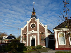 Church in Thesinge | |
 Flag Coat of arms | |
 Location in Groningen | |
| Coordinates: 53°17′N 6°42′E / 53.283°N 6.700°ECoordinates: 53°17′N 6°42′E / 53.283°N 6.700°E | |
| Country | Netherlands |
| Province | Groningen |
| Municipality | Groningen |
| Merged | 2019 |
| Area | |
| • Total | 45.73 km2 (17.66 sq mi) |
| • Land | 45.30 km2 (17.49 sq mi) |
| • Water | 0.43 km2 (0.17 sq mi) |
| Elevation | 1 m (3 ft) |
| Time zone | UTC+1 (CET) |
| • Summer (DST) | UTC+2 (CEST) |
| Postcode | 9790–9799 |
| Area code | 050 |
| Website | www |


Drawing bridge near the Wolddijk-Stadsweg
Ten Boer (Dutch pronunciation: [tɛn ˈbuːr] (![]() listen)) is a village and a former municipality in the northeastern Netherlands, in the province of Groningen. The municipality had a population of in 2019; the village of Ten Boer has approximately 4,600 inhabitants.
listen)) is a village and a former municipality in the northeastern Netherlands, in the province of Groningen. The municipality had a population of in 2019; the village of Ten Boer has approximately 4,600 inhabitants.
Population centres[]
, , , Ten Boer, , Thesinge, Winneweer, and .

Dutch topographic map of the municipality of Ten Boer, June 2015
Notable people from Ten Boer[]
- Dirk van der Borg (born 1955), mayor of Graafstroom and Molenwaard
- Paul Drewes (born 1982), Olympic rower
- Hendrik Nienhuis (1790-1862), jurist and parliament member
- Remco van der Schaaf (born 1979), football player
References[]
- ^ "Kerncijfers wijken en buurten 2020" [Key figures for neighbourhoods 2020]. StatLine (in Dutch). CBS. 24 July 2020. Retrieved 19 September 2020.
- ^ "Postcodetool for 9791CT". Actueel Hoogtebestand Nederland (in Dutch). Het Waterschapshuis. Retrieved 4 February 2014.
- ^ "Bevolkingsontwikkeling; regio per maand" [Population growth; regions per month]. CBS Statline (in Dutch). CBS. 1 January 2019. Retrieved 1 January 2019.
External links[]
 Media related to Ten Boer at Wikimedia Commons
- Official website
| hide Places adjacent to Ten Boer | ||||||||||
|---|---|---|---|---|---|---|---|---|---|---|
| ||||||||||
| Authority control |
|---|
This Groningen location article is a stub. You can help Wikipedia by . |
Categories:
- Groningen (city)
- Former municipalities of Groningen (province)
- Populated places in Groningen (province)
- Groningen (province) geography stubs