The Peel Centre, Stockport
 | |
 | |
| Location | Stockport, United Kingdom |
|---|---|
| Coordinates | 53°24′50″N 2°09′05″W / 53.41389°N 2.15139°W |
| Address | Great Portwood Street, Stockport, Greater Manchester, SK1 2HH[1] |
| Opening date | 1980s |
| Management | Peel Land and Property Savills (Agents)[2] |
| Owner | The Peel Group |
| No. of stores and services | 20 |
| No. of anchor tenants | 3 |
| Total retail floor area | 230,000 sq ft[3] |
| No. of floors | Varies |
| Parking | 1,057[1] |
| Website | The Peel Centre, Stockport |


The Peel Centre is a retail park located in Stockport, Greater Manchester. It currently contains 20 units, with all currently occupied[4] It is owned and operated by the Peel Land and Property Division of The Peel Group. It currently extends to 230,000 sq ft (21,000 m2), with units varying in size.[3] It is located close to the town centre shopping areas, including the Merseyway Shopping Centre,[5] with which it competes for similar tenants.
The site on which the park stands has had a variety of different usages over time, it previously had industry and housing.[6] It then contained a power station and gas works, and then had a variety of industrial usages,[7] it was only developed in its current form from the late 1980s onwards. It was constructed in phases with the latter phases being those at the eastern side.
Transport links[]
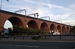
The M60 motorway is adjacent to the centre, and junction 27 (Portwood Roundabout) is located at the eastern corner of the centre, this makes it accessible to a large catchment population in the Greater Manchester Urban Area, and as it competes actively with nearby shopping parks (e.g. Snipe Retail Park, Ashton-under-Lyne), succeeding in attracting large numbers of shoppers every year.
Further information[]
There is extensive car parking at the centre where there has been controversy over wrongly issued parking fines,[8] it is mainly pay and display,[1] and is close to the town's major supermarkets.
Immediately adjacent to The Peel Centre, across the road is a smaller development, Portwood Court, complementing the centre.
In 2003, IKEA announced plans to open a store on the other side of the Portwood Roundabout and M60, but were denied planning permission, and after numerous appeals they were finally turned down in 2005 by the then Deputy Prime Minister John Prescott.[9] The first IKEA store in Greater Manchester opened in 2006, in neighbouring Ashton-under-Lyne.
References[]
- ^ a b c "The Peel Centre - Retail Warehousing - Scheme Overview on Completely Retail". Completely Retail. Retrieved 13 August 2010.
- ^ Craig Hudson (n.d.). "Savills - Out of Town Retail - Out of Town Retail Agency Team" (PDF). Savills. Retrieved 26 August 2010.
- ^ a b "Peel Land and Property - The Peel Centre, Stockport - A vibrant consumer mix". Peel Land and Property. Archived from the original on 20 July 2011. Retrieved 12 August 2010.
- ^ with many major retailers represented. "Peel Land and Property - The Peel Centre, Stockport - Availability" (JPEG). Peel Land and Property. Retrieved 12 August 2010.
- ^ "Stockport Council - Town Centre Shopping Areas". Stockport Council. Retrieved 13 August 2010.
- ^ NS Roberts (n.d.). "Stockport Image Archive - Andrew Square/Portwood". Stockport Council. The area now covered by The Peel Centre is from the top right, bounded by Great Portwood Street with the tramway running along it, and bounded to at the bottom by the River Mersey bridge. Retrieved 14 August 2010.
- ^ Stockport Advertiser (April 1981). "Stockport Image Archive - Aerial View over Portwood". Stockport Council. The area now covered by The Peel Centre is on the left side of the Photograph, as far as the cooling tower and as far as the road on the right hand side.
- ^ "The car park where 'hundreds' are fined up to £100 even AFTER paying for ticket".
- ^ Brian Lashley (19 February 2005). "Manchester Evening News - Ikea loses battle for £30m store". Manchester Evening News.
Coordinates: 53°24′50″N 2°09′05″W / 53.41389°N 2.15139°W

- Buildings and structures in Stockport
- Shopping centres in Greater Manchester
- Retail parks in the United Kingdom
- The Peel Group