Tobe, Ehime
Tobe
砥部町 | |
|---|---|
Town | |
 Flag  Emblem | |
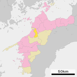 Location of Tobe in Ehime Prefecture | |
 Tobe Location in Japan | |
| Coordinates: 33°45′N 132°48′E / 33.750°N 132.800°ECoordinates: 33°45′N 132°48′E / 33.750°N 132.800°E | |
| Country | Japan |
| Region | Shikoku |
| Prefecture | Ehime Prefecture |
| District | Iyo |
| Area | |
| • Total | 101.57 km2 (39.22 sq mi) |
| Population (May 1, 2017) | |
| • Total | 21,471 |
| • Density | 210/km2 (550/sq mi) |
| Time zone | UTC+09:00 (JST) |
| City hall address | 1392 Miyauchi, Tobe-chō, Iyo-gun, Ehime-ken 791-2195 |
| Website | www |
| Symbols | |
| Flower | Ume (梅) |
| Tree | Sawtooth Oak (櫟, Kunugi) |

Tobe (砥部町, Tobe-chō) is a town located in Iyo District, Ehime Prefecture, Japan.
As of January 1, 2005, the village of Hirota, also from Iyo District, was merged into Tobe.
As of May 1, 2017, the town has an estimated population of 21,471 and a density of 210 persons per km².[1] The total area is 101.57 km².
Geography[]
Surrounding municipalities[]
Education[]
Ehime Prefectural University of Health Science is located in the town. Furthermore, Tobe contains a high school, a junior high school and three elementary schools.
Transportation[]
Highways[]
- Matsuyama Expressway
- Japan national routes
Gallery[]
Konpirasan Park
Rishoin Temple
Tobe Thrust Fault


References[]
- ^ "Official website of Tobe Town" (in Japanese). Japan: Tobe Town. Retrieved 26 May 2017.
External links[]
 Media related to Tobe, Ehime at Wikimedia Commons
- Tobe official website (in Japanese)
| show Authority control |
|---|
This Ehime Prefecture location article is a stub. You can help Wikipedia by . |
Categories:
- Towns in Ehime Prefecture
- Ehime geography stubs