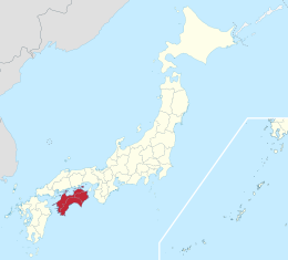
Shikoku
Coordinates: 33°45′N 133°30′E / 33.750°N 133.500°E

This article needs additional citations for verification. (July 2007) |
Native name: 四国 | |
|---|---|
 The island of Shikoku, Japan | |
 | |
| Geography | |
| Location | Japan |
| Archipelago | Japanese archipelago |
| Area | 18,801.73 km2 (7,259.39 sq mi) |
| Area rank | 50th |
| Length | 225 km (139.8 mi) |
| Width | 50–150 km (31–93 mi) |
| Highest elevation | 1,982 m (6503 ft) |
| Highest point | Mount Ishizuchi |
| Administration | |
| Prefectures | |
| Largest settlement | Matsuyama (pop. 514,865[1]) |
| Demographics | |
| Population | 3,845,534 (2015) |
| Pop. density | 204.55/km2 (529.78/sq mi) |
| Ethnic groups | Japanese |
Shikoku (四国, literally "four provinces") is one of the five main islands of Japan. Shikoku is the second-smallest main island after Okinawa.[2] It is 225 km or 139.8 mi long and between 50 and 150 km or 31.1 and 93.2 mi wide. It has a population of 3.8 million (as of 2015, 3.1%). It is south of Honshu and northeast of Kyushu.[3] Shikoku's ancient names include Iyo-no-futana-shima (伊予之二名島), Iyo-shima (伊予島), and Futana-shima (二名島), and its current name refers to the four former provinces that made up the island: Awa, Tosa, Sanuki, and Iyo.[4]
Geography[]

Shikoku island, comprising Shikoku and its surrounding islets, covers about 18,800 square kilometres (7,259 sq mi) and consists of four prefectures: Ehime, Kagawa, Kōchi, and Tokushima. Across the Seto Inland Sea lie Wakayama, Osaka, Hyōgo, Okayama, Hiroshima, and Yamaguchi Prefectures on Honshu. To the west lie Ōita and Miyazaki Prefectures on Kyushu.

The 50th largest island by area in the world, Shikoku is smaller than Sardinia and Bananal, but larger than Halmahera and Seram. By population, it ranks 23rd, having fewer inhabitants than Sicily or Singapore, but more than Puerto Rico or Negros.
Mountains running east and west divide Shikoku into a narrow northern subregion, fronting on the Seto Inland Sea, and a southern part facing the Pacific Ocean. The Hydrangea hirta species can be found in these mountain ranges. Most of the 3.8 million inhabitants live in the north, and all but one of the island's few larger cities are located there. Mount Ishizuchi (石鎚山) in Ehime at 1,982 m (6,503 ft) is the highest mountain on the island. Industry is moderately well developed and includes the processing of ores from the important Besshi copper mine. Land is used intensively. Wide alluvial areas, especially in the eastern part of the zone, are planted with rice and subsequently are double-cropped with winter wheat and barley. Fruit is grown throughout the northern area in great variety, including citrus fruits, persimmons, peaches, and grapes. Because of wheat production, Sanuki udon (讃岐うどん) became an important part of the diet in Kagawa Prefecture (formerly Sanuki Province) in the Edo period.
The larger southern area of Shikoku is mountainous and sparsely populated. The only significant lowland is a small alluvial plain at Kōchi, the prefectural capital. The area's mild winters stimulated some truck farming, specializing in growing out-of-season vegetables under plastic covering. Two crops of rice can be cultivated annually in the southern area. The pulp and paper industry took advantage of the abundant forests and hydroelectric power.
The major river in Shikoku is the Yoshino River. It runs 196 km (121.8 mi) from its source close to Mount Ishizuchi, flowing basically west to east across the northern boundaries of Kōchi and Tokushima Prefectures, reaching the sea at the city of Tokushima. The Yoshino is famous for Japan's best white-water rafting, with trips going along the Oboke Koboke sections of the river.
Shikoku has four important capes: Gamōda in Anan, Tokushima on the easternmost point on the island, Sada in Ikata, and Ehime on the westernmost point. Muroto in Muroto, Kōchi and Ashizuri, the southern extreme of Shikoku, in Tosashimizu, Kōchi, jut into the Pacific Ocean. The island's northernmost point is in Takamatsu, Kagawa.
Unlike the other three major islands of Japan, Shikoku has no active volcanoes, and is the largest of Japan's islands to completely lack them.[5] But Shikoku did experience volcanic activity in the distant prehistoric past; a major volcanic caldera in the area of Mount Ishizuchi was active during the Miocene around 14 million years ago.[6]

Mount Ishizuchi is the highest mountain in Shikoku

Cape Ashizuri is at the southernmost tip of Shikoku


Population[]
Shikoku has a total population of 3,845,534 in 2015.[2][4] The largest city is Matsuyama (population: 509,835) and is the capital of Ehime Prefecture. Shikoku is the main island with the third largest population density, at 204.55 inhabitants per square kilometre (529.8/sq mi).
| City(-shi) | Inhabitants |
|---|---|
| Matsuyama | 509,835 |
| Takamatsu | 418,994 |
| Kōchi | 332,059 |
| Tokushima | 321,654 |
| Uwajima | 86,631 |
| Naruto | 58,543 |
| Mima | 30,062 |

Matsuyama City

Tokushima City

Per Japanese census data,[7] and,[8] Shikoku region's peak population was at 1950 and has had negative population growth from 1950 to 1970 and 1990 onward.
| Year | Pop. | ±% |
|---|---|---|
| 1920 | 3,066,000 | — |
| 1930 | 3,310,000 | +8.0% |
| 1940 | 3,337,000 | +0.8% |
| 1950 | 4,221,000 | +26.5% |
| 1960 | 4,122,000 | −2.3% |
| 1970 | 3,904,000 | −5.3% |
| 1980 | 4,163,000 | +6.6% |
| 1990 | 4,195,000 | +0.8% |
| 2000 | 4,154,039 | −1.0% |
| 2010 | 3,977,282 | −4.3% |
| 2018 | 3,755,765 | −5.6% |
Culture[]
Society and architecture[]
Shikoku has historically been rather isolated and therefore it has kept the original characteristics of Japan for a longer period, especially in regards to vegetation and some architectural techniques. There are many Buddhist temples.
The "lost" Shikoku has been described by an American writer, Alex Kerr, who lived in a remote mountain village near Oboke (大歩危) for many years from 1970 onwards.
Ashizuri-Uwakai National Park is located in the south-western part of Shikoku.
Traditions[]

Shikoku is also famous for its 88-temple pilgrimage of temples. The pilgrimage was established by the ancient Buddhist priest Kūkai, a native of Shikoku. According to legend, the monk would still appear to pilgrims today. Most modern-day pilgrims travel by bus, rarely choosing the old-fashioned method of going by foot. They are seen wearing white jackets emblazoned with the characters reading dōgyō ninin meaning "two traveling together".
Tokushima Prefecture also has its annual Awa Odori running in August at the time of the Obon festival, which attracts thousands of tourists each year from all over Japan and from abroad.
Kōchi Prefecture is home to the first annual Yosakoi festival. The largest festival in Kōchi, it takes place in August every year and attracts dancers and tourists from all over Japan.
Food[]

One of the major foods of Shikoku is udon.[9] Udon is often served hot as a noodle soup in its simplest form, as kake udon, in a mildly flavoured broth called , which is made of dashi, soy sauce (shōyu), and mirin. It is usually topped with thinly chopped scallions. Other common toppings include tempura, often prawn or kakiage (a type of mixed tempura fritter), or aburaage, a type of deep-fried tofu pockets seasoned with sugar, mirin, and soy sauce. A thin slice of kamaboko, a halfmoon-shaped fish cake, is often added. Shichimi can be added to taste. Another specialty is Kōchi's signature dish, seared bonito.
The warm climate of Shikoku lends itself to the cultivation of citrus fruits. As a result, yuzu, mikan and other citrus fruits are plentiful on Shikoku and have become synonymous with the regions they are grown in.
Movements[]
Pioneering natural farmer Masanobu Fukuoka, author of The One-Straw Revolution, developed his methods here on his family's farm.
Sports[]


Historically no Shikoku-based sports team has competed in the top Japanese division of baseball, football (soccer) or even rugby union. Currently the major teams competing in Shikoku's major cities include:
- Naruto, Tokushima: Tokushima Vortis (football, J. League Division 1), Tokushima Indigo Socks (baseball, Shikoku-Kyūshū Island League)
- Matsuyama, Ehime: Ehime F.C. (J2), Ehime Mandarin Pirates (SKIL)
- Takamatsu, Kagawa: Kamatamare Sanuki (JFL), Kagawa Olive Guyners (SKIL)
- Kōchi, Kōchi: Kōchi Fighting Dogs (SKIL)
Notable sportspeople[]
Two time darts Women's World Champion Mikuru Suzuki is a native of Takamatsu in Kagawa Prefecture on Shikoku.[10]
Transportation[]


Roads[]
Shikoku is connected to Honshu by three expressways, which together form the Honshū–Shikoku Bridge Project.
- Kobe-Awaji-Naruto Expressway (Eastern Shikoku)
- Seto-Chūō Expressway (Central Shikoku)
- Nishiseto Expressway (Western Shikoku)
The eastern gateway to Shikoku, Naruto in Tokushima Prefecture has been linked to the Kobe-Awaji-Naruto Expressway since 1998. This line connects Shikoku to the Kansai area which has a large population, including the large conurbations of Osaka, Kyoto, and Kobe. Therefore, the Kobe-Awaji-Naruto Expressway carries a large traffic volume. Many highway buses are operated between Kansai and Tokushima Prefecture.
The central part of Shikoku is connected to Honshu by ferry, air, and – since 1988 – by the Great Seto Bridge network. Until completion of the bridges, the region was isolated from the rest of Japan. The freer movement between Honshu and Shikoku was expected to promote economic development on both sides of the bridges, which has not materialized yet.
Within the island, a web of national highways connects the major population centers. These include Routes 11, 32, 33, 55, and 56.
Rail[]
The Shikoku Railway Company (JR Shikoku) serves the island and connects to Honshu via the Great Seto Bridge. JR lines include:
- Yosan Line
- Dosan Line
- Kōtoku Line
- Tokushima Line
- Mugi Line
- Naruto Line
- Uchiko Line
- Yodo Line
- Honshi Bisan Line
- Seto Ōhashi Line
Private railway lines operate in each of the four prefectures on Shikoku.
Air travel[]
Shikoku lacks a full international airport but has four regional/domestic airports (Tokushima Airport, Takamatsu Airport, Kōchi Ryōma Airport and Matsuyama Airport). All of these airports have flights to Tokyo and other major Japanese cities such as Osaka, Nagoya, Sapporo, and Fukuoka. International flights to Seoul, South Korea are serviced by Asiana Airlines from Matsuyama and Takamatsu. There are periodic international charter flights as well.
Sea Travel
Ferries link Shikoku to destinations including Honshu, Kyushu, and islands around Shikoku.
See also[]
- Japanese archipelago
- Geography of Japan
- Regions of Japan
- Shikoku dialect
References[]
- ^ "Matsuyama (City (-shi), Ehime, Japan) - Population Statistics, Charts, Map and Location". www.citypopulation.de. Archived from the original on 28 April 2016. Retrieved 1 May 2018.
- ^ Jump up to: a b "離島とは(島の基礎知識) (what is a remote island?)". MLIT (Ministry of Land, Infrastructure, Transport and Tourism) (in Japanese). Ministry of Land, Infrastructure, Transport and Tourism. 22 August 2015. Archived from the original (website) on 2007-07-13. Retrieved 9 August 2019.
MILT classification 6,852 islands(main islands: 5 islands, remote islands: 6,847 islands)
- ^ Boquet, Yves (2017). The Philippine Archipelago. Springer. p. 16. ISBN 9783319519265.
- ^ Jump up to: a b "Shikoku and Awaji Island" (PDF). Japan National Tourism Organization. September 2011. Archived (PDF) from the original on 2013-02-04. Retrieved 2013-05-02.
- ^ "Shikoku: Frommer's Guide from". Answers.com. Archived from the original on 2012-02-29. Retrieved 2012-02-28.
- ^ Takehara, Mami; Horie, Kenji; Tani, Kenichiro; Yoshida, Takeyoshi; Hokada, Tomokazu; Kiyokawa, Shoichi (2017). "Timescale of magma chamber processes revealed by U-Pb ages, trace element contents and morphology of zircons from the Ishizuchi caldera, Southwest Japan Arc". Island Arc. 26 (2): e12182. doi:10.1111/iar.12182.
- ^ Ehime 1995-2020 population statistics
- ^ Shikoku 1920-2000 population statistics
- ^ "tourism shikoku". tourism shikoku. Organization for Promotion of Tourism in Shikoku. Archived from the original on 2014-12-05. Retrieved 2014-11-27.
- ^ "Japan's Miracle Takes Darts World by Storm". France24.com. France 24. Retrieved 7 August 2020.
- Japan: A country study. Federal Research Division.
 This article incorporates text from this source, which is in the public domain.
External links[]
| Wikimedia Commons has media related to Shikoku. |
| Look up shikoku in Wiktionary, the free dictionary. |
| Wikivoyage has a travel guide for Shikoku. |

| show Authority control |
|---|
- Shikoku region
- Japanese archipelago
- Islands of Ehime Prefecture
- Islands of Kagawa Prefecture
- Islands of Kōchi Prefecture
- Islands of Tokushima Prefecture