Topola, Lower Silesian Voivodeship
Topola | |
|---|---|
Village | |
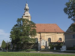 Church of Saint Bartholomew | |
 Topola | |
| Coordinates: 50°30′0″N 16°55′25″E / 50.50000°N 16.92361°ECoordinates: 50°30′0″N 16°55′25″E / 50.50000°N 16.92361°E | |
| Country | |
| Voivodeship | Lower Silesian |
| County | Ząbkowice Śląskie |
| Gmina | Kamieniec Ząbkowicki |

Topola [tɔˈpɔla] (German: Reichenau) is a village in the administrative district of Gmina Kamieniec Ząbkowicki, within Ząbkowice Śląskie County, Lower Silesian Voivodeship, in south-western Poland.[1] Prior to 1945 it was in Germany. It lies approximately 5 kilometres (3 mi) south-east of Kamieniec Ząbkowicki, 12 km (7 mi) south-east of Ząbkowice Śląskie, and 70 km (43 mi) south of the regional capital Wrocław.
References[]
| hide | ||
|---|---|---|
| Seat |  | |
| Other villages | ||
This Ząbkowice Śląskie County location article is a stub. You can help Wikipedia by . |
Categories:
- Villages in Ząbkowice Śląskie County
- Ząbkowice Śląskie County geography stubs