Toronto Lake (Kansas)
| Toronto Lake | |
|---|---|
 Toronto Lake | |
 | |
| Location | Woodson / Greenwood counties in Kansas |
| Coordinates | 37°45′49″N 95°56′10″W / 37.7635764°N 95.9360638°WCoordinates: 37°45′49″N 95°56′10″W / 37.7635764°N 95.9360638°W[1] |
| Type | Reservoir |
| Primary outflows | Verdigris River |
| Basin countries | United States |
| Managing agency | U.S. Army Corps of Engineers |
| Built | 1960 |
| Settlements | Toronto, Coyville |
| References | [2] |


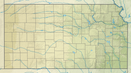
Toronto Lake is a flood control lake in southeast Kansas, primarily in Woodson County. It is located on the Verdigris River about 4 miles southeast of Toronto, Kansas. The lake is maintained by the U.S. Army Corps of Engineers.[3]
History[]
Toronto Lake was authorized in the Flood Control Act of 1941. Construction started on the lake in November 1954 and it was completed in February 1960.[3] In addition to flood control, the lake serves for recreational purposes, to improve water quality, and potentially to supply water.
See also[]
- Cross Timbers State Park
- Fall River Lake, southwest of Toronto Lake
- List of Kansas state parks
- List of lakes, reservoirs, and dams in Kansas
- List of rivers of Kansas
References[]
- ^ "Toronto Lake". Geographic Names Information System. United States Geological Survey. Retrieved Jan 17, 2021.
- ^ "Toronto Dam". Geographic Names Information System. United States Geological Survey. July 1, 1984. Retrieved January 15, 2021.
- ^ a b Toronto Reservoir 50th Anniversary
External links[]
- Toronto Lake
- Woodson County Maps: Current, Historic, KDOT
- Greenwood County Maps: Current, Historic, KDOT
Categories:
- Protected areas of Greenwood County, Kansas
- Reservoirs in Kansas
- Protected areas of Woodson County, Kansas
- Bodies of water of Woodson County, Kansas
- Bodies of water of Greenwood County, Kansas
- Kansas geography stubs
- Southeast Kansas geography stubs